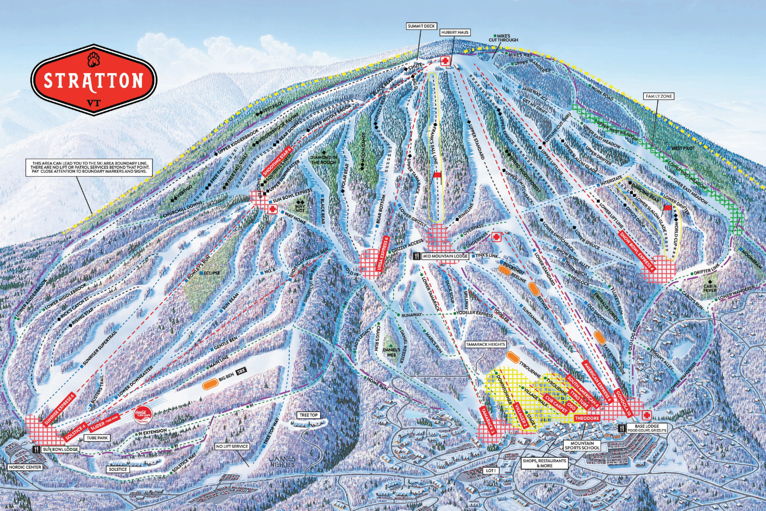
Stratton Ski Map Download 👇
Stratton Piste Map and Overview
Stratton Mountain Resort, located in southern Vermont, is renowned for its expansive terrain and diverse offerings, making it a top destination for skiers and snowboarders of all levels. With 99 trails spread across 670 acres (2.7 km²), the resort provides a variety of runs suitable for beginners to advanced skiers. The resort boasts a vertical drop of 2,003 feet (611 meters), offering long, exhilarating descents. Snowmaking covers approximately 95% of the terrain, ensuring consistent conditions throughout the season. Stratton’s summit elevation is 3,875 feet (1,181 meters), making it the highest peak in southern Vermont.
In addition to its impressive ski terrain, Stratton Mountain Resort offers a range of amenities, including a vibrant village with shops, restaurants, and accommodations. The resort’s commitment to providing a comprehensive mountain experience makes it a standout choice for winter enthusiasts seeking both adventure and comfort.
Ski area size = 100 km / 62 miles
Base elevation = 571 m / 1,872 ft
Peak elevation: 1,181 m / 3,875 ft
Difficulty:
🟦 65% Easy
🟥 22% Intermediate
⬛ 13% Advanced
