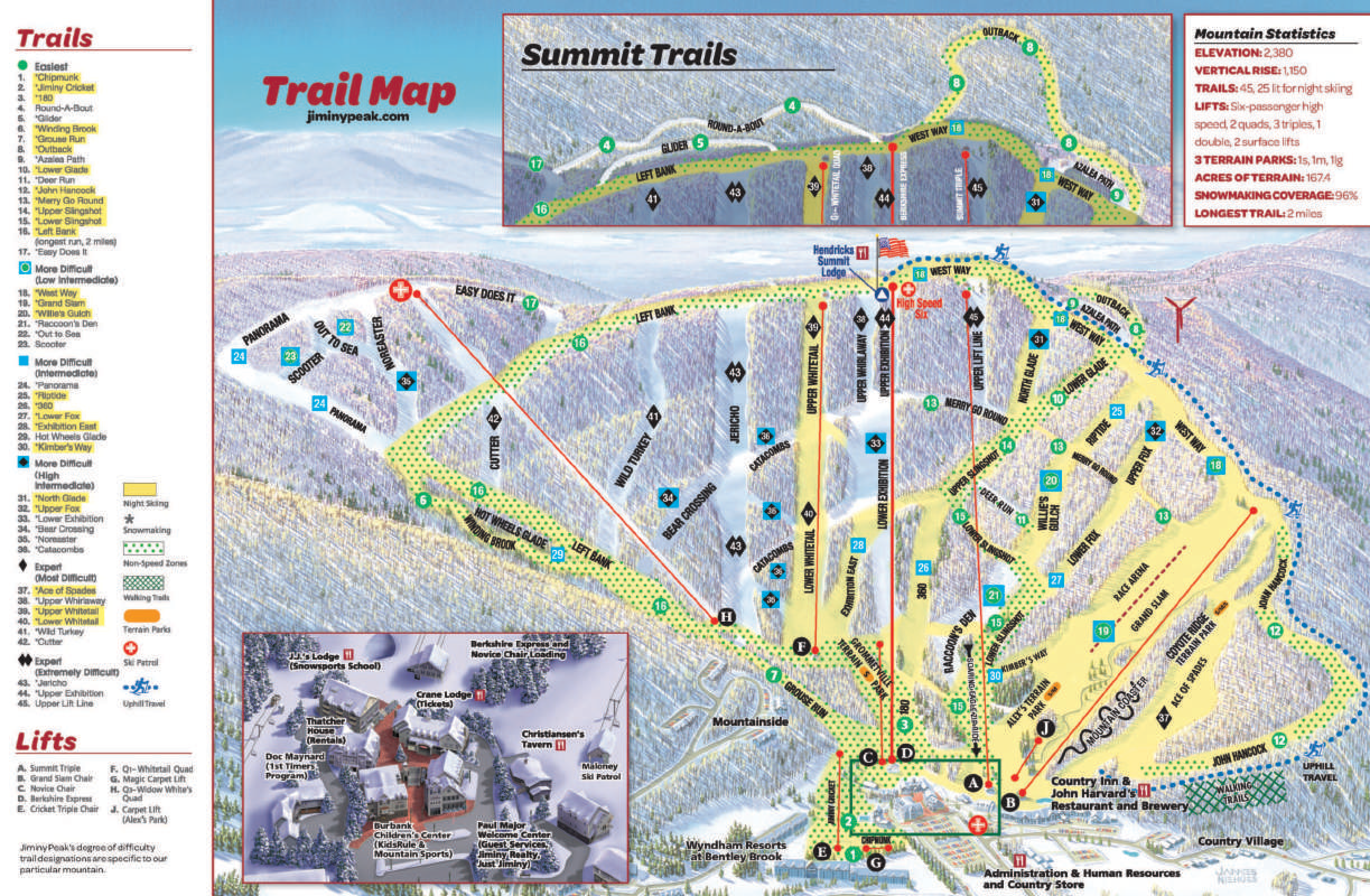
Jiminy Peak Ski Map Download 👇
Jiminy Peak Piste Map and Overview
Jiminy Peak Mountain Resort, nestled in the Berkshires of western Massachusetts, offers a well-rounded skiing experience suitable for all skill levels. With 45 trails spread across 170 acres (approximately 68.8 hectares) of skiable terrain, the resort provides a diverse range of options, from gentle beginner slopes to challenging expert runs. The mountain boasts a vertical drop of 1,150 feet (351 meters) and a longest run stretching two miles (3.2 kilometers), ensuring ample space for extended descents. Jiminy Peak’s extensive snowmaking capabilities cover 96% of the terrain, complemented by an average annual snowfall of 100 inches (254 centimeters), guaranteeing reliable conditions throughout the season. The resort’s lift system includes nine lifts, featuring a high-speed six-passenger chairlift, facilitating efficient access to the slopes.
Beyond the slopes, Jiminy Peak distinguishes itself with a strong commitment to sustainability. In 2007, it became the first ski area in North America to generate power from its own wind turbine, a 1.5 MW GE model, which supplies approximately 35% of the resort’s annual energy needs. This initiative is part of a broader environmental strategy that includes a 2.3 MW solar facility and a 75 kWh cogeneration unit, enabling the resort to operate entirely on renewable energy sources. These efforts not only reduce the resort’s carbon footprint but also enhance the overall guest experience by promoting environmental stewardship.
Ski area size = 9.1 km / 5.7 miles
Base elevation = 380 m / 1,245 ft
Peak elevation = 724 m / 2,380 ft
Difficulty:
🟦 45% Easy
🟥 22% Intermediate
⬛ 33% Advanced
