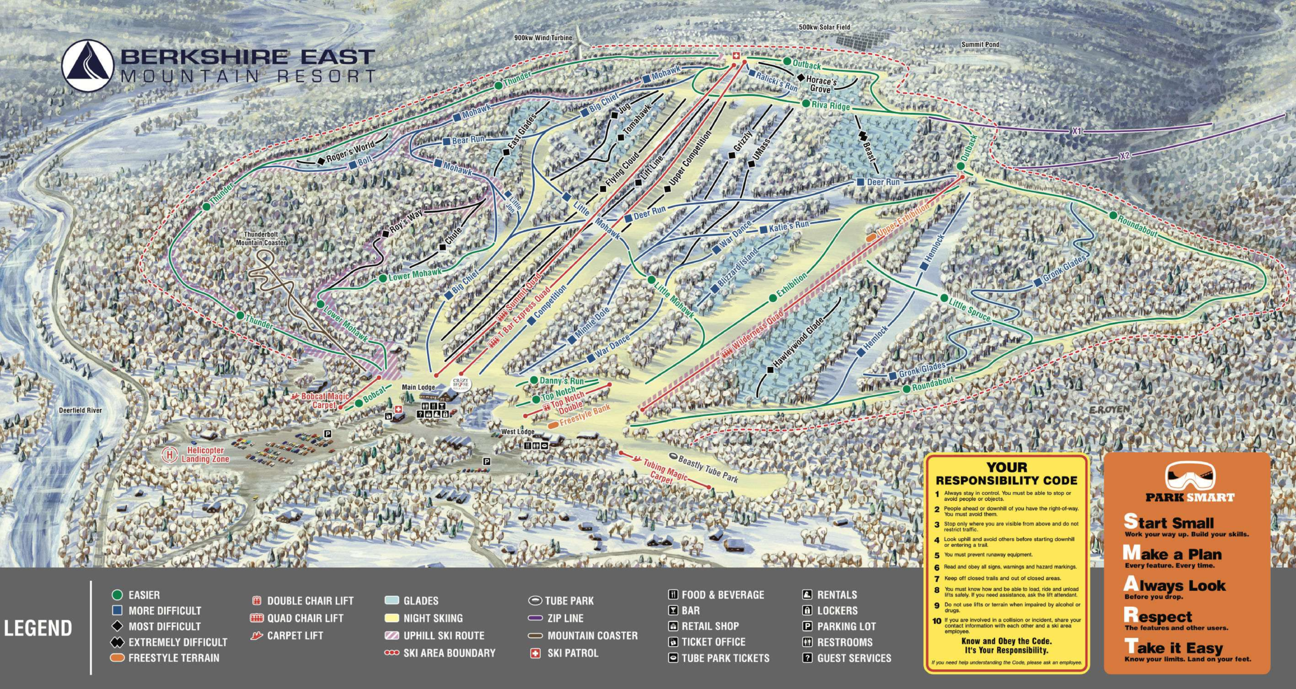
Berkshire East Ski Map Download 👇
Berkshire East Piste Map and Overview
Berkshire East Mountain Resort in Charlemont, Massachusetts, is a fantastic destination for skiers seeking a blend of diverse terrain, eco-conscious operations, and a welcoming community vibe. The resort offers a variety of trails suitable for all skill levels, with 45 trails spread across approximately 180 to 200 acres of skiable terrain . Notably, Berkshire East is powered entirely by on-site renewable energy, including a 900kW wind turbine and a 500kW solar facility, making it the first ski area in the world to achieve this feat .
In addition to its impressive sustainability efforts, Berkshire East boasts a vertical drop of 1,180 feet (360 meters), providing thrilling descents for adventure seekers . The resort is equipped with five lifts, including a high-speed detachable quad, ensuring quick and efficient access to the slopes . With 100% snowmaking coverage and an average annual snowfall of 110 inches (279 cm), visitors can expect reliable conditions throughout the season . Whether you’re a seasoned skier or a beginner, Berkshire East offers a memorable and environmentally responsible skiing experience.
Ski area size = 13 km / 8.1 miles
Base elevation = 201 m / 660 ft
Peak elevation = 561 m / 1,840 ft
Difficulty:
🟦 46% Easy
🟥 31% Intermediate
⬛ 23% Advanced
