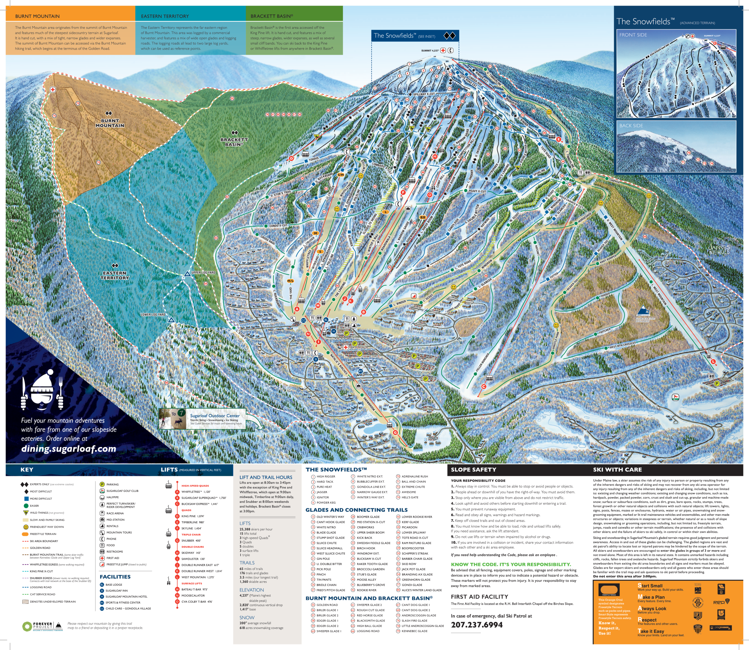
Sugarloaf Mountain Ski Map Download 👇
Sugarloaf Mountain Piste Map and Overview
Sugarloaf Mountain, located in Carrabassett Valley, Maine, is one of the premier ski destinations in the northeastern United States. With a summit elevation of 4,237 feet (1,291 meters) and a vertical drop of 2,820 feet (860 meters), it offers a diverse range of terrain across 176 trails and glades. The resort boasts 1,360 acres of skiable terrain, including the only lift-serviced, above-treeline skiing in the East, providing an unparalleled alpine experience. Sugarloaf receives an average annual snowfall of 200 inches (508 cm) and has snowmaking capabilities covering 95% of its terrain, ensuring reliable conditions throughout the season.
The trail difficulty at Sugarloaf is well-balanced, catering to all skill levels: 22% beginner, 32% intermediate, 25% advanced, and 21% expert. The resort’s lift system includes 15 lifts, providing efficient access to its expansive terrain. Notably, Sugarloaf features a longest run stretching 3.5 miles (5.6 kilometers), offering ample opportunities for extended descents.
Ski area size = 1,360 acres / 5.5 km²
Base elevation = 1,417 ft / 432 m
Peak elevation = 4,237 ft / 1,291 m
Difficulty:
🟦 23% Easy
🟥 34% Intermediate
⬛ 43% Advanced
