Tatranská Lomnica Ski Map Download 👇
Tatranská Lomnica Piste Map and Overview
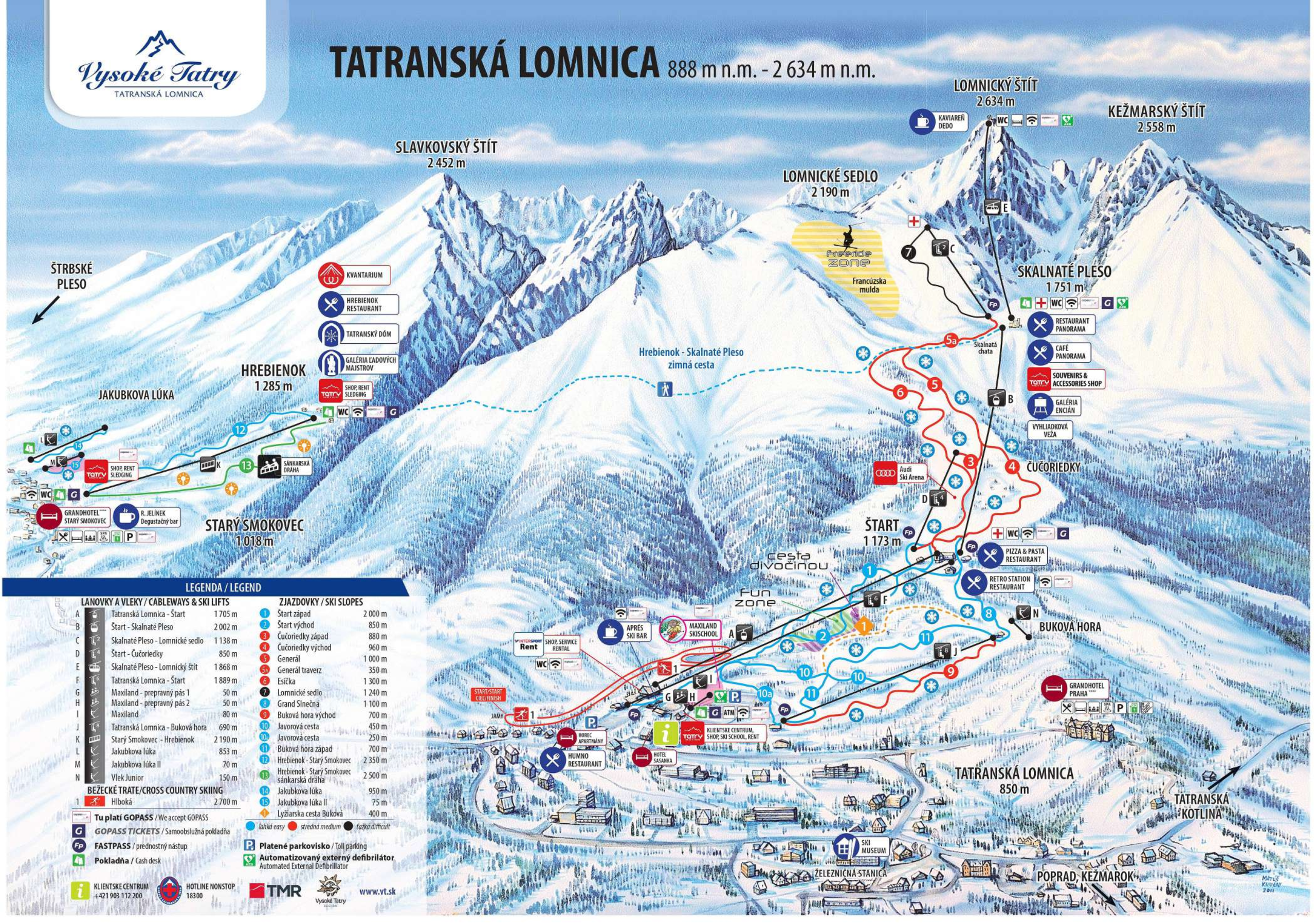
Tatranská Lomnica, nestled in Slovakia’s High Tatras, is the country’s highest-altitude ski resort and a premier destination for winter sports enthusiasts. The resort boasts approximately 11.8 km (7.3 miles) of groomed slopes, offering a mix of blue, red, and black runs that cater to skiers of varying skill levels. The ski area spans elevations from 888 m (2,913 ft) to 2,190 m (7,185 ft), providing a vertical drop of 1,302 m (4,272 ft), the largest in the High Tatras. Modern lift infrastructure, including gondolas and chairlifts, ensures efficient access to the slopes.
Beyond alpine skiing, Tatranská Lomnica offers a range of winter activities, including snowboarding, sledging, and winter hiking. The resort’s location within the Tatra National Park provides a picturesque setting, with trails that cater to both classic and skate skiing styles. Additionally, the resort features a snow park and offers night skiing on selected runs, extending the skiing experience into the evening hours.
Total ski area: 11.8 km / 7.3 miles
Base elevation: 888 m / 2,913 ft
Peak elevation: 2,190 m / 7,185 ft
Difficulty:
🟦 44% Blue
🟥 46% Red
⬛ 10% Black