Štrbské Pleso Ski Map Download 👇
Štrbské Pleso Piste Map and Overview
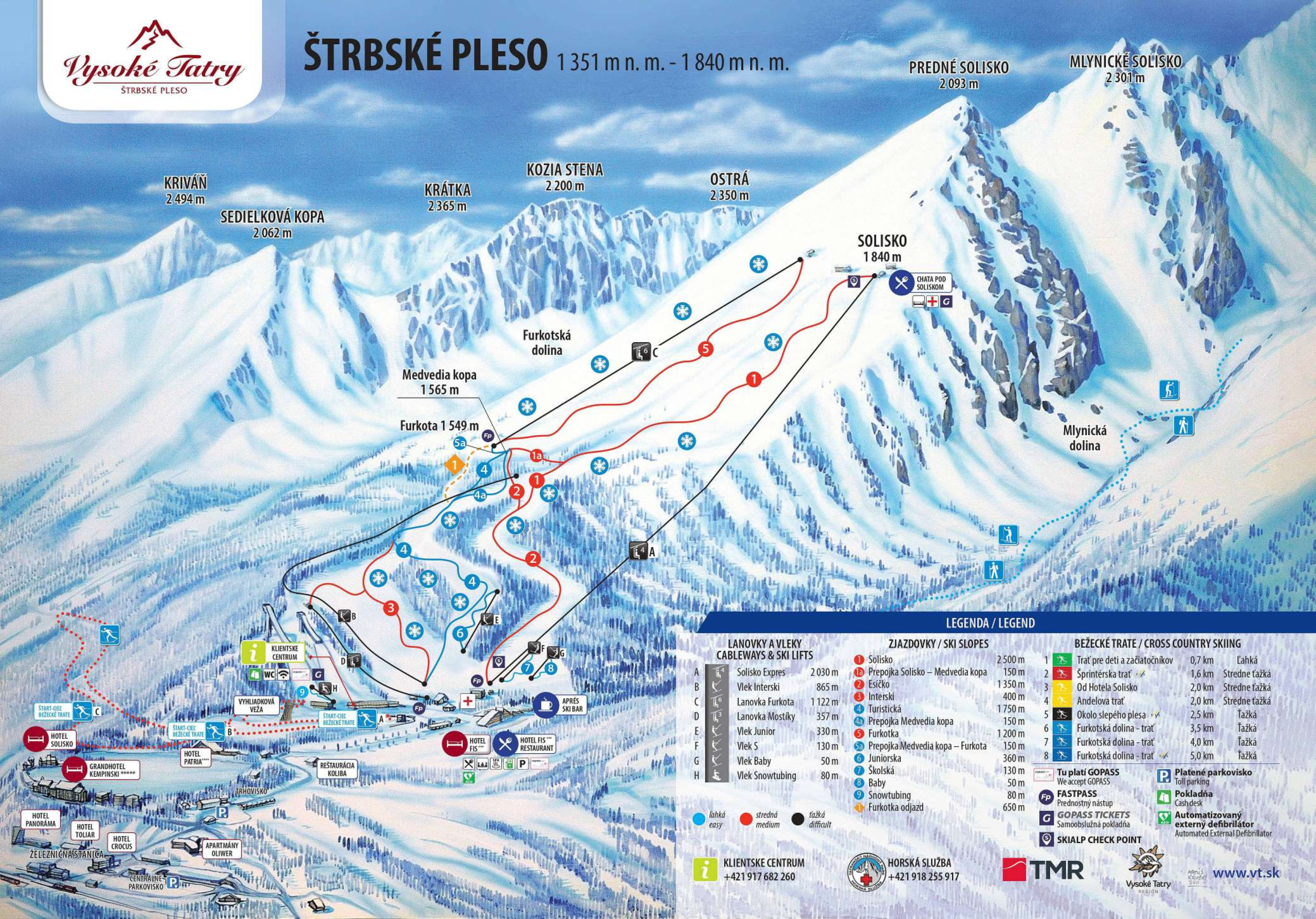
Štrbské Pleso, nestled in Slovakia’s High Tatras, is the country’s highest ski resort, offering a serene alpine experience ideal for families and intermediate skiers. With its picturesque setting around a glacial lake and elevations ranging from 1,380 m (4,527 ft) to 1,824 m (5,984 ft), the resort provides reliable snow conditions throughout the season. The ski area boasts approximately 9 km (5.6 mi) of well-groomed slopes, primarily catering to beginners and intermediates, complemented by modern lift infrastructure and 100% snowmaking coverage.
Beyond downhill skiing, Štrbské Pleso is renowned for its extensive cross-country trails, totaling up to 26.5 km (16.5 mi), and a snow park featuring jumps and rails for freestyle enthusiasts. The resort’s tranquil atmosphere, combined with quality services and a range of accommodations, from traditional lodges to luxury hotels, makes it a compelling destination for those seeking both adventure and relaxation in a stunning mountain setting.
Total ski area: 9 km / 5.6 miles
Base elevation: 1,380 m / 4,527 ft
Peak elevation: 1,824 m / 5,984 ft
Difficulty:
🟦 33% Blue
🟥 67% Red
⬛ 0% Black