
Zakopane – Kasprowy Wierch Ski Map Download 👇
Zakopane – Kasprowy Wierch Piste Map and Overview
Zakopane, Poland, is a charming mountain town and one of Eastern Europe’s most popular ski destinations, located at the foot of the Tatra Mountains. Zakopane is split into several different maps, we have done our best top provide all of them on this page!
Known as the “Winter Capital of Poland,” Zakopane combines traditional Polish highlander culture with a vibrant winter sports scene. The town itself is full of rustic wooden architecture, local craft markets, and a range of restaurants serving delicious Polish cuisine. Beyond skiing, Zakopane offers a rich cultural experience, including horse-drawn sleigh rides, thermal spas, and a lively après-ski atmosphere, all of which make it a great destination for families and groups seeking a diverse winter getaway.
The skiing in Zakopane is spread across several smaller ski areas, with Kasprowy Wierch being the most prominent. It offers around 16 kilometers (10 miles) of skiable terrain and is known for its alpine-style slopes and stunning views of the surrounding Tatra Mountains. Kasprowy Wierch is best suited for intermediate and advanced skiers, with steep runs and off-piste options, while beginners can enjoy the more gentle slopes at other nearby areas like Gubałówka and Nosal. Though Zakopane’s ski areas are smaller compared to some of the major Alpine resorts, they are well-equipped with modern lifts and provide a fantastic, scenic ski experience. With its combination of cultural charm, a range of slopes, and winter activities, Zakopane is a unique and affordable ski destination in Europe.
Zakopane – Harenda Piste Map
Zakopane – Harenda Ski Map Download 👇
Zakopane – Gubałówka Piste Map

Zakopane – Gubałówka Ski Map Download 👇
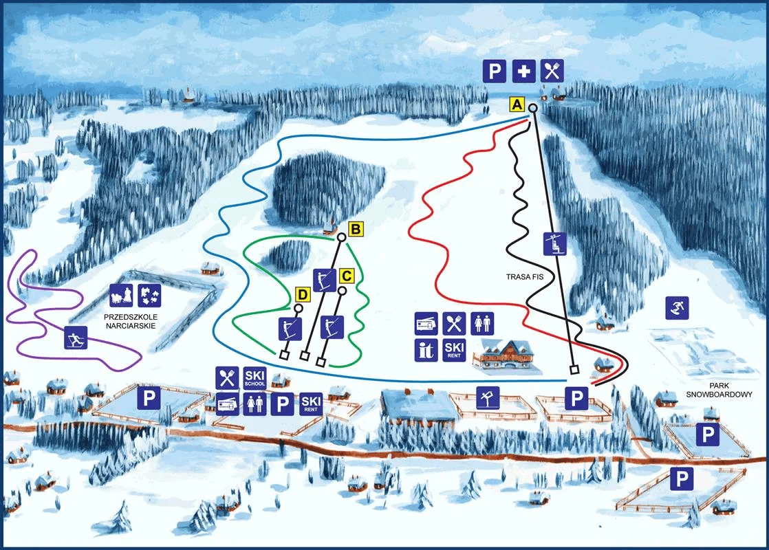
Zakopane – Szymoszkowa Piste Map

Zakopane – Szymoszkowa Ski Map Download 👇
Zakopane – Nosal Piste Map
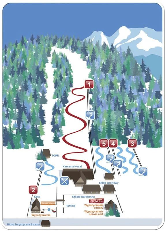
Zakopane – Nosal Ski Map Download 👇
Total ski area: Approximately 16 km / 10 miles (Kasprowy Wierch, with additional skiing in Gubałówka and Nosal)
Base elevation: 1,014 m / 3,327 ft
Peak elevation: 1,987 m / 6,520 ft
Difficulty:
🟦 20% Blue
🟥 60% Red
⬛ 20% Black