Marmolada Ski Map Download 👇
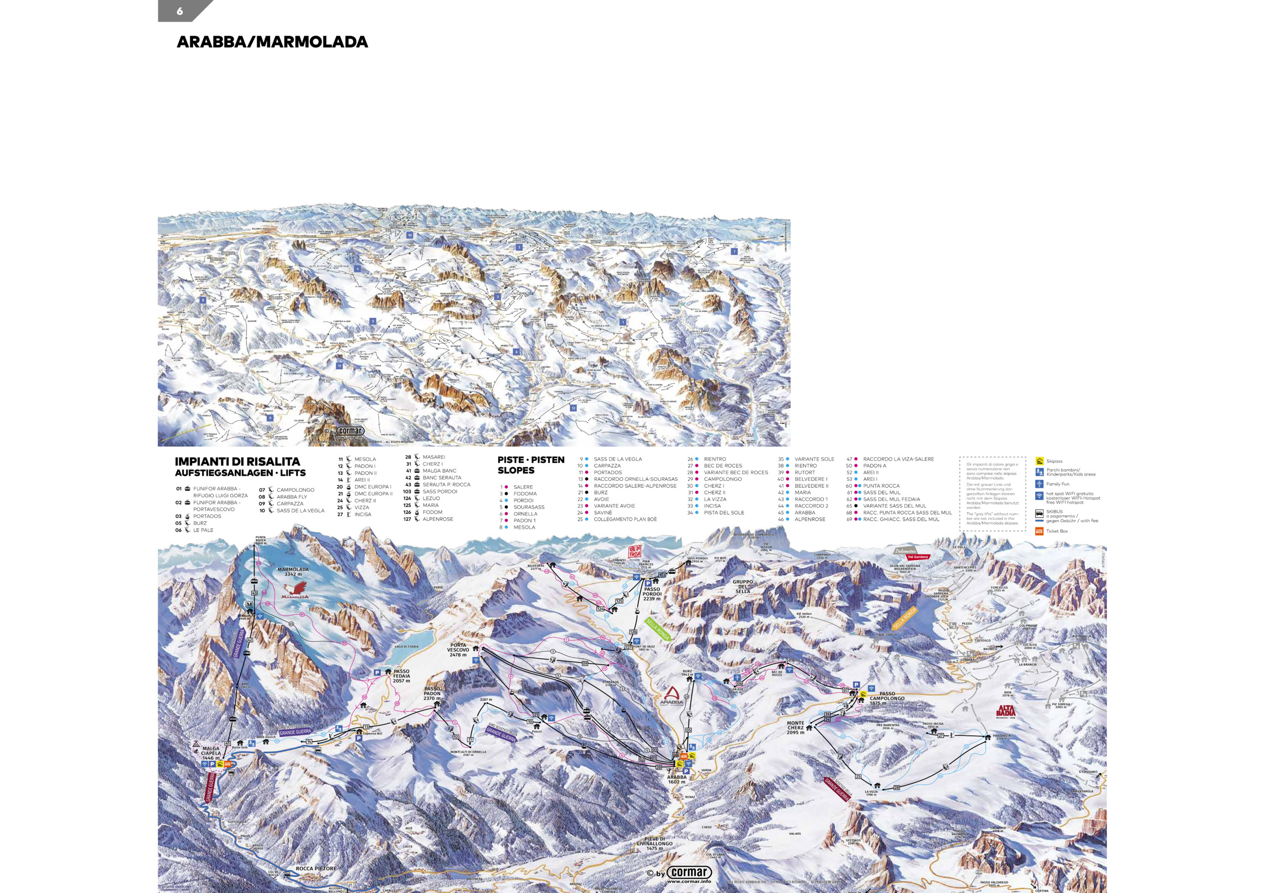
Marmolada Piste Map and Overview
Marmolada, known as the “Queen of the Dolomites,” is the highest peak in the Dolomite range, reaching 3,343 meters (10,968 feet) at Punta Penia. This majestic mountain offers a unique skiing experience, featuring the renowned “La Bellunese” run—a 12 km (7.5 miles) descent with a vertical drop of 1,823 meters (5,981 feet), making it one of the longest and most exhilarating slopes in the Dolomites. The ski area is part of the expansive Dolomiti Superski network, providing access to a vast array of interconnected slopes and modern lift systems. Skiers can ascend via the Marmolada cable car to Punta Rocca (3,269 m / 10,728 ft), offering panoramic views and direct access to the glacier’s pristine runs.
Beyond its impressive skiing terrain, Marmolada holds significant historical and geological importance. During World War I, it served as a strategic frontline, with soldiers carving tunnels into its glacier—a testament to its storied past. Today, visitors can explore the Marmolada Glacier Museum, which delves into this rich history. The mountain’s northern face hosts the largest glacier in the Dolomites, offering a unique opportunity to witness glacial formations and understand their impact on the region’s ecosystem. With its blend of challenging slopes, historical significance, and natural beauty, Marmolada provides an unparalleled alpine experience for winter sports enthusiasts and history buffs alike.
Total ski area: 12 km / 7.5 miles
Base elevation: 1,446 m / 4,744 ft
Peak elevation: 3,343 m / 10,968 ft
Difficulty:
🟦 37% Easy
🟥 49% Intermediate
⬛ 14% Advanced