Courmayeur Ski Map Download 👇
Courmayeur Piste Map and Overview
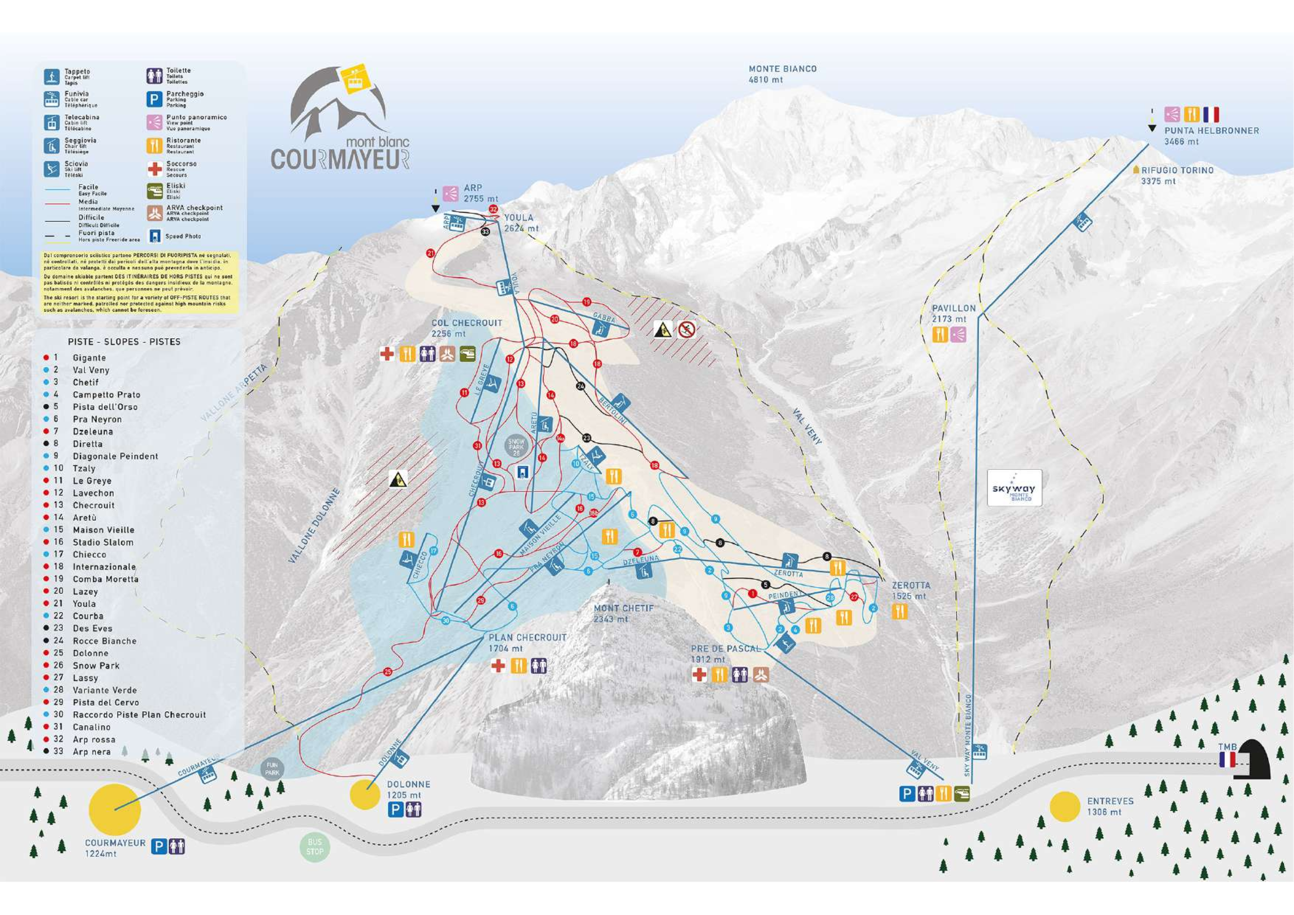
Courmayeur, nestled in Italy’s Aosta Valley at the foot of Mont Blanc, offers a captivating blend of alpine charm, diverse skiing terrain, and gourmet dining. The resort features approximately 41.5 km (25.8 miles) of groomed pistes, predominantly catering to intermediate skiers, with a mix of wide-open runs and scenic tree-lined trails . For advanced skiers, Courmayeur provides access to off-piste adventures and heliskiing opportunities, including routes on the Mont Blanc massif . The ski area is well-served by 18 lifts, ensuring efficient access across the slopes.
Beyond skiing, Courmayeur is renowned for its sophisticated après-ski scene and culinary excellence. The town’s cobbled Via Roma is lined with upscale boutiques and inviting cafés, offering a vibrant atmosphere for relaxation after a day on the slopes . With its combination of scenic beauty, quality skiing, and cultural richness, Courmayeur provides an exceptional alpine experience.
Total ski area: 41.5 km / 25.8 miles
Base elevation: 1,224 m / 4,016 ft
Peak elevation: 2,755 m / 9,039 ft
Difficulty:
🟦 38% Easy
🟥 51% Intermediate
⬛ 11% Advanced