Ruhestein Ski Map Download 👇
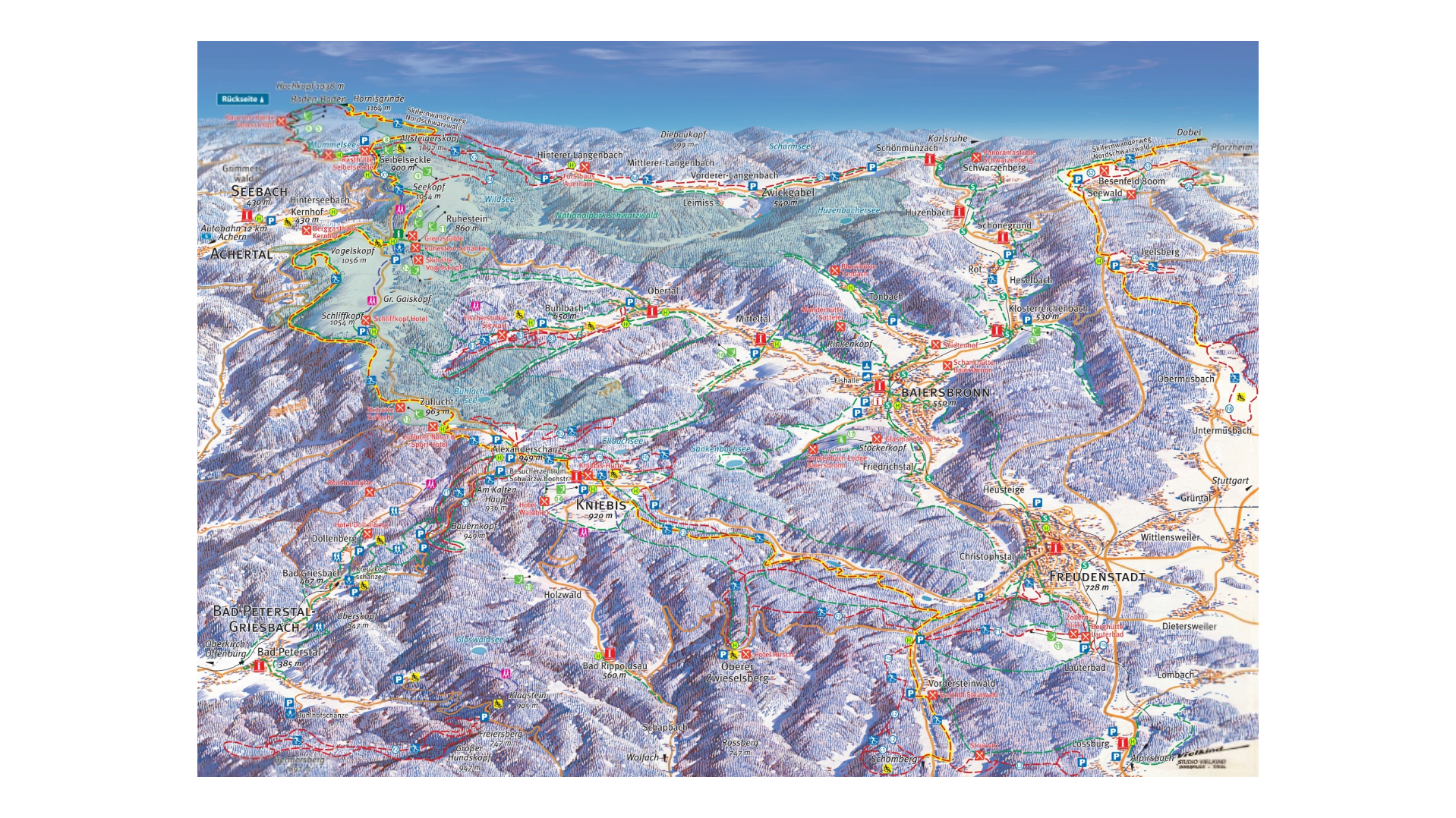
Ruhestein Piste Map and Overview
Ruhestein – Baiersbronn offers a cozy and family-friendly skiing experience in the heart of the Black Forest, Germany. With 1 km (0.62 miles) of slopes and two T-bar lifts, it caters primarily to beginners and those seeking a relaxed atmosphere away from the bustle of larger resorts. The resort’s base elevation is 915 m (3,002 ft), with a peak at 1,014 m (3,327 ft), providing a modest vertical drop of 99 m (325 ft). This gentle terrain makes it an excellent choice for novice skiers and families looking for a safe and enjoyable environment to learn and practice.
Beyond skiing, Ruhestein is a gateway to outdoor adventures, including hiking and cross-country skiing, especially within the nearby Black Forest National Park. The area is also home to the historic Große Ruhesteinschanze ski jump, adding a touch of tradition to the region’s winter sports heritage. Whether you’re a beginner skier or someone seeking a peaceful retreat in nature, Ruhestein – Baiersbronn offers a charming and accessible destination.
Total ski area size: 1 km / 0.62 miles
Base elevation: 915 m / 3,002 ft
Peak elevation:1,014 m / 3,327 ft
Difficulty:
🟦 100% Easy
🟥 0% Intermediate
⬛ 0% Advanced