Tetnuldi Ski Map Download 👇
Tetnuldi Piste Map and Overview
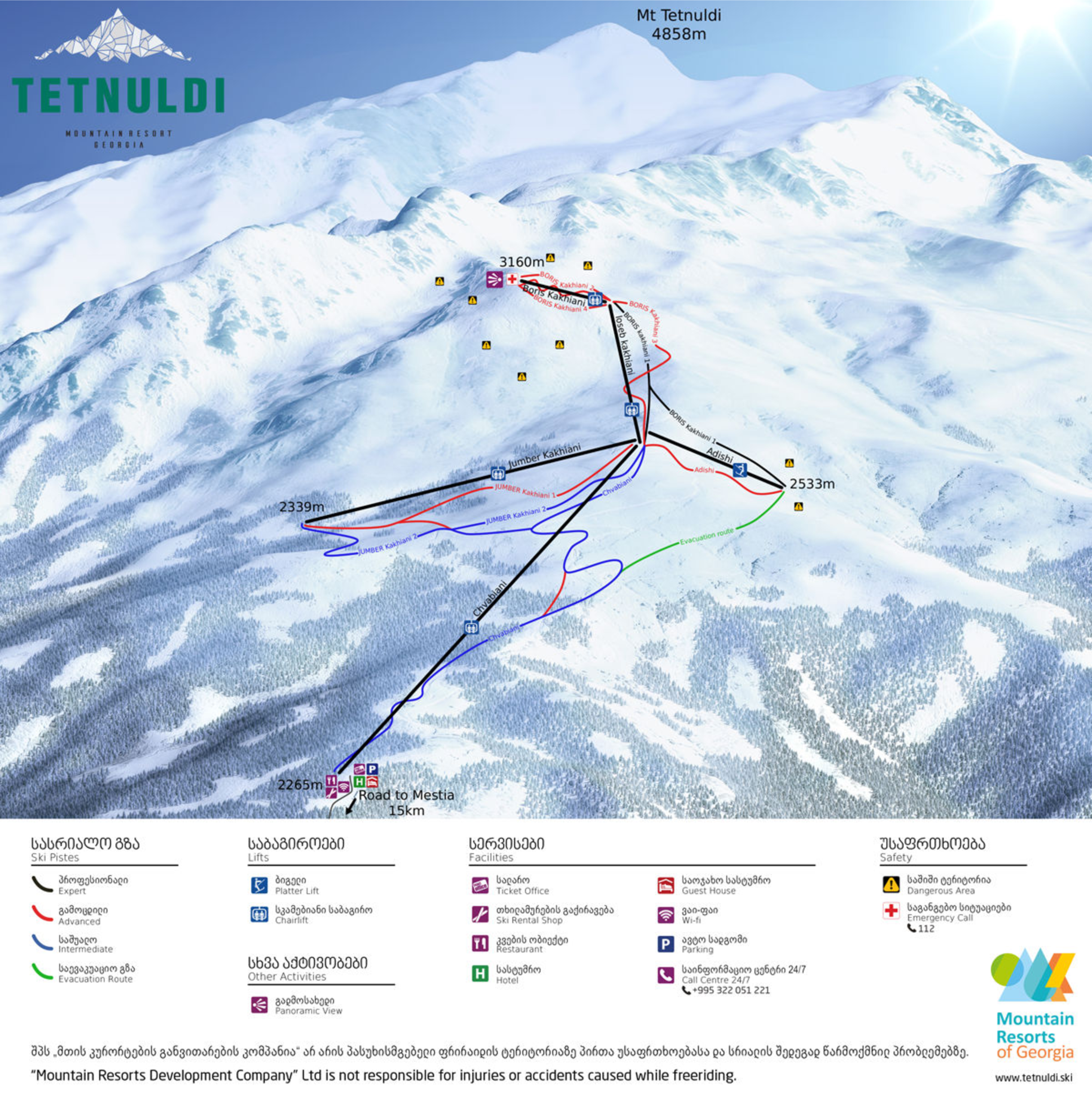
Tetnuldi Ski Resort, situated in Georgia’s Svaneti region near Mestia, is renowned for its high-altitude terrain and exceptional freeride opportunities. The resort spans elevations from 2,265 meters (7,431 feet) to 3,160 meters (10,367 feet), offering a vertical drop of approximately 895 meters (2,936 feet) . With around 13.7 km (8.5 miles) of groomed slopes, Tetnuldi caters to a range of skill levels, featuring a notable 9.5 km (5.9 miles) run—the longest in the South Caucasus region . The resort’s high elevation ensures reliable snow conditions throughout the season, making it a prime destination for both on-piste and off-piste skiing.
Beyond its marked trails, Tetnuldi is a haven for advanced skiers and snowboarders seeking off-piste adventures. The resort’s expansive alpine bowls and couloirs provide ample opportunities for freeride and backcountry skiing, attracting enthusiasts from around the world . The combination of challenging terrain, deep snow, and breathtaking mountain vistas makes Tetnuldi a standout choice for those looking to experience Georgia’s rugged winter landscapes.
Total ski area: 13.7 km / 8.5 miles
Base elevation: 2,265 m / 7,431 ft
Peak elevation: 3,160 m / 10,367 ft
Difficulty:
🟦 38% Easy
🟥 46% Intermediate
⬛ 16% Advanced