Les Gets Ski Map Download 👇
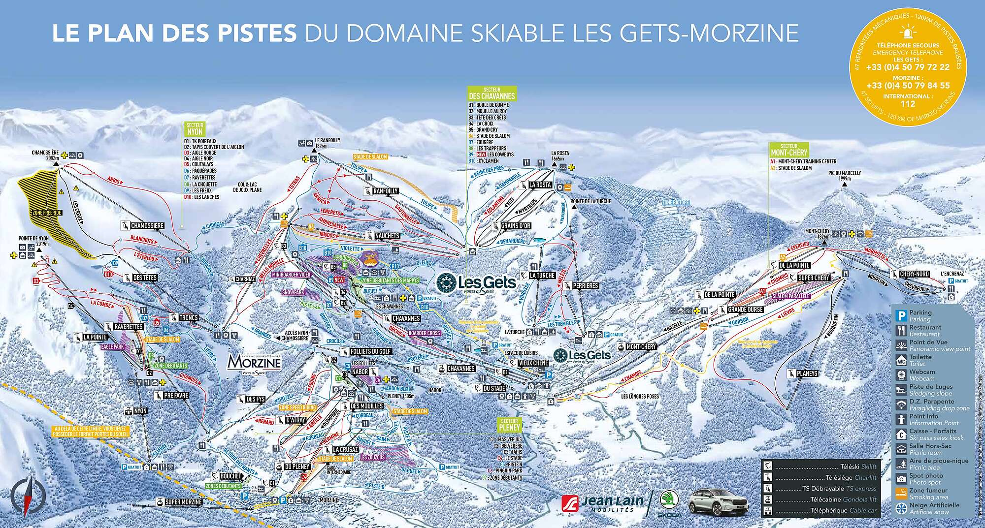
Les Gets Piste Map and Overview
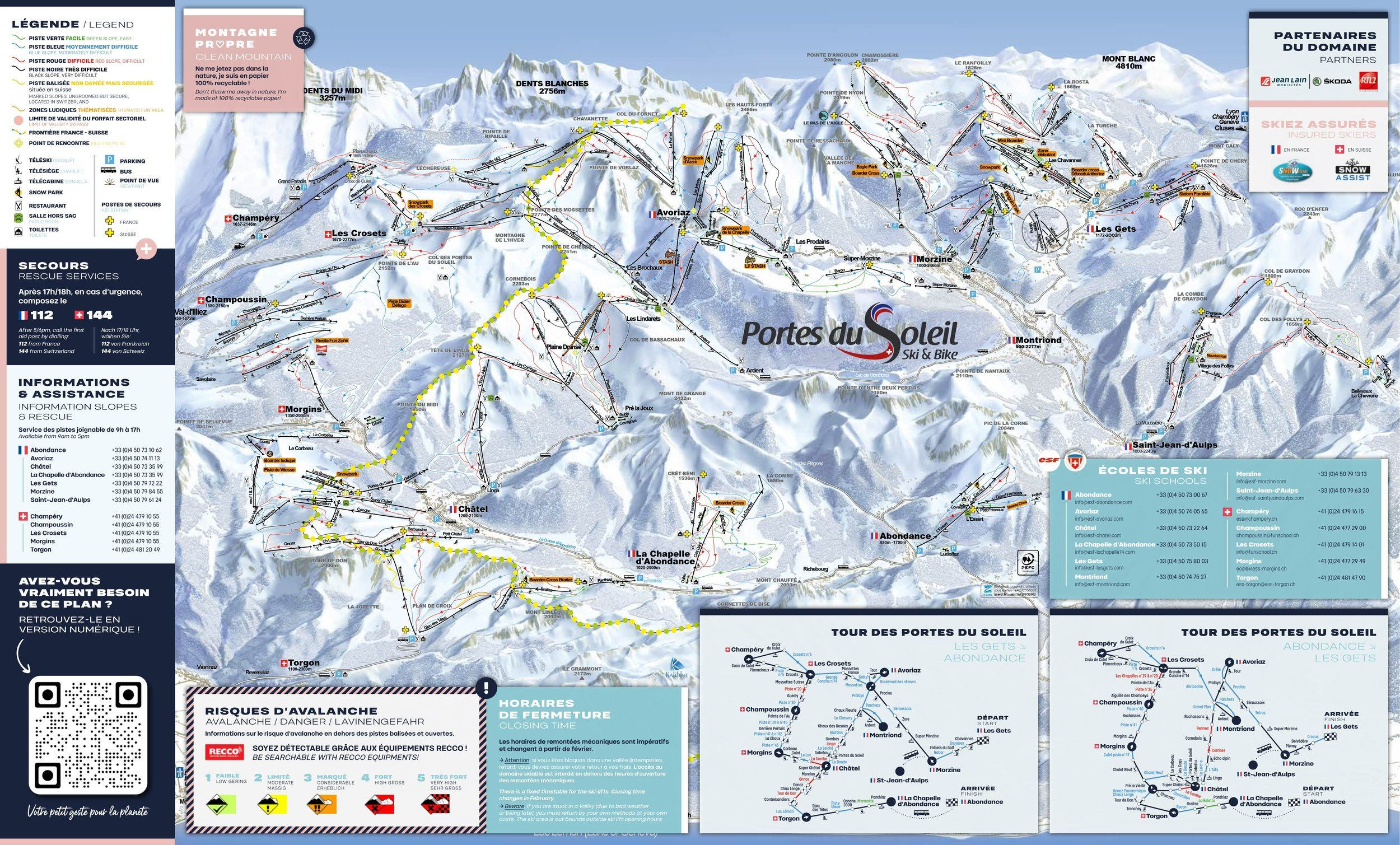
Nestled in the French Alps between Lake Geneva and Mont Blanc, Les Gets is a charming alpine village at about 1,172 m altitude. It forms part of the larger Portes du Soleil ski domain, meaning you can access an enormous interconnected ski network while staying in a village that retains authentic Savoyard character, with wooden chalets, forested runs, and family-friendly facilities. The resort offers a pleasing mix of gentle slopes for beginners and tree-lined trails for intermediates, yet thanks to the link to Portes du Soleil it also opens the door to far more terrain if you’re keen to explore beyond the local area.
It’s particularly well suited for families or mixed-ability groups who want a comfortable base, good village amenities and the option of big-area skiing without staying in a mega-resort. The fact that it remains relatively accessible from Geneva makes it a strong option for those modest on travel time but big on alpine atmosphere.
Total ski area: 107 km / 66.5 miles
Base elevation: 1,172 m / 3,845 ft
Peak elevation: 2,002 m / 6,568 ft
Difficulty:
🟦 54% Easy
🟥 36% Intermediate
⬛ 10% Advanced
What’s included in the Les Gets Ski Pass?
- The Les Gets ski pass comes in a few options. One is the local pass for Les Gets–Morzine, which covers about 120 km of pistes within that specific area.
- However, that local pass does not give access to the whole Portes du Soleil ski domain.
- To ski across the full Portes du Soleil area – which includes 12 resorts in France and Switzerland, with hundreds of lifts and pistes – you need a Portes du Soleil ski pass.
- So just to confirm – if you only buy the local Les Gets–Morzine one, you are limited to that sub-area. If you want to explore the wider Portes du Soleil, you need the full-area pass.