Peyragudes Ski Map Download 👇
Peyragudes Piste Map and Overview
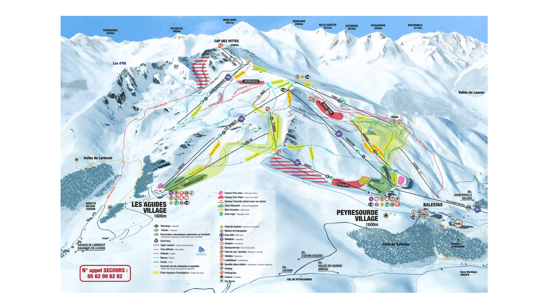
Perched in the central French Pyrenees, Peyragudes is a modern, well-equipped ski area renowned for its sunny slopes and panoramic mountain views. The resort offers a mix of wide, groomed pistes and more challenging terrain, making it perfect for families, beginners, and intermediates. Its south-facing slopes ensure plenty of sunshine, while higher-altitude runs provide reliable snow and breathtaking views across the Pyrenean peaks.
Peyragudes is especially appreciated for its variety and accessibility. Beginners can take advantage of gentle blue runs and dedicated learning zones, while intermediates enjoy longer red slopes that traverse the resort. Advanced skiers and snowboarders can find selective black runs and off-piste areas for added challenge. The compact lift system and modern infrastructure make it easy to navigate the resort efficiently, giving everyone – from families to solo riders – a smooth and enjoyable skiing experience.
Total ski area: 60 km / 37 miles
Base elevation: 1,600 m / 5,249 ft
Peak elevation: 2,400 m / 7,874 ft
Difficulty:
🟦 50% Easy
🟥 43% Intermediate
⬛ 7% Advanced
Ski Season Length and Dates
Typically mid-December to late April, depending on snow conditions.
Is it good for beginners?
Peyragudes is beginner-friendly. Half of the slopes are easy, and dedicated beginner zones make it simple for novices to build confidence before moving to red runs.
What’s Included in the Ski Pass?
- Access to all lifts at Peyragudes
- Blue, red, and black runs
- Beginner and practice slopes
- Snowpark (when open)
- Shuttle connections within the resort
Pass options
- The pass covers the entire Peyragudes domain.
- Since it’s a single resort, cheaper sector-only passes aren’t typically offered; the full pass provides access to all lifts and slopes.