Val Thorens Ski Map Download 👇
Val Thorens Piste Map and Overview
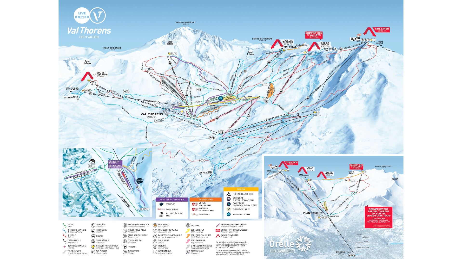
Val Thorens sits high – very high — and that’s one of its biggest selling points. At 2,300 m for the resort base and up to 3,230 m on its peaks, Val Thorens offers truly snow‑sure skiing, often with a longer season than many lower resorts. The terrain is modern, open, and varied: you’ll find fast, wide runs for carving, challenging glacier terrain, and steep sections that reward confident skiers and boarders. There’s also a great snowpark and freeride options, making it a real all-rounder for fun-seekers.
Beyond just the skiing, Val Thorens has a unique alpine “ski‑in / ski‑out” feel – most accommodation is built around the slopes, so you’re never far from the action. Despite being purpose-built, the resort has evolved a lot: there’s a lively après-scene, plenty of restaurants, and a relaxed but high‑energy atmosphere. Because it’s part of the massive Trois Vallées network, you’ve got access to hundreds of kilometres of linked terrain, making Val Thorens a very strategic and exciting base.
Total ski area: 150 km / 93 miles
Base elevation: 1,825 m / 5,988 ft
Peak elevation: 3,230 m / 10,597 ft
Difficulty:
🟦 56% Easy
🟥 34% Intermediate
⬛ 10% Advanced
What’s included in the Val Thorens Ski Pass?
- There is a local Val Thorens‑Orelle pass, which gives you access to the 150 km of pistes in the Val Thorens / Orelle sector, so you don’t always need the full 3 Vallées pass if you plan to stay mainly in the Val Thorens / Orelle zone.
- The Les 3 Vallées ski pass includes Val Thorens – giving access not just to the resort itself, but also to Courchevel, Méribel, Les Menuires, and other linked valleys.
