Saint-Véran Ski Map Download 👇
Saint-Véran Piste Map and Overview
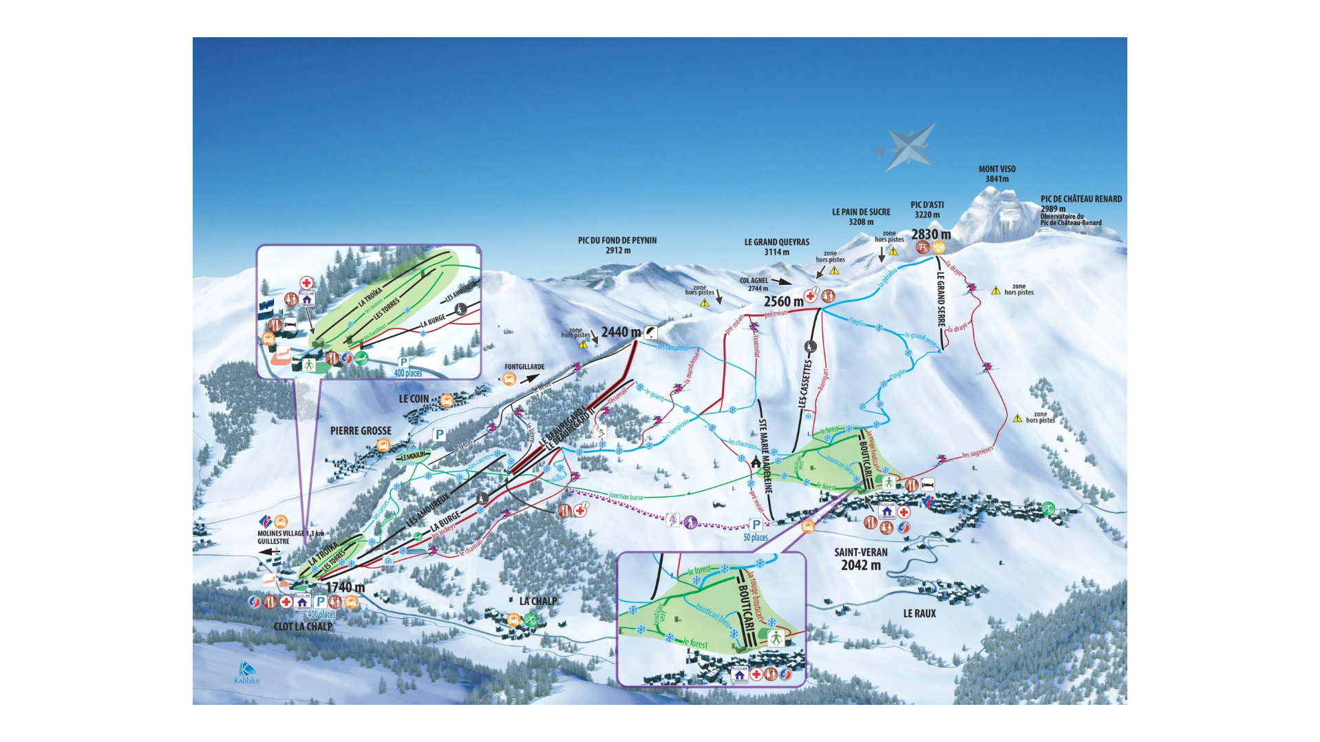
Tucked into the high alpine setting of the Queyras Regional Natural Park in the French Southern Alps, Molines‑en‑Queyras / Saint-Véran offers a beautifully authentic, low‑crowd ski experience. The village retains a traditional mountain character, with wooden chalets and panoramic views, making it a great pick if you’re looking to combine skiing with tranquillity and mountain atmosphere rather than high‑speed large resort action. The high altitude of the base (around 1,740 m) helps snow reliability and ensures you’re skiing above many of the valley fogs or lower crowds.
On the slopes, Molines‑en‑Queyras offers terrain that caters nicely to a range of abilities – beginners will find gentler runs, intermediates ample variety, and the altitude provides enough vertical drop to make things interesting for more confident skiers. Although it’s not vast compared to mega‑resorts, the combination of high elevation, scenic setting, and fewer lift queues makes it appealing for families, couples or those seeking a relaxed mountain escape. The link with neighbouring Saint‑Véran enhances the value by adding extra terrain and variety. (The same uplift network serves both areas.)
Total ski area: 32 km / 19.9 miles
Base elevation: 1,740 m / 5,709 ft
Peak elevation: 2,830 m / 9,285 ft
Difficulty:
🟦 61% Easy
🟥 36% Intermediate
⬛ 3% Advanced