Le Lys Ski Map Download 👇
Le Lys Piste Map and Overview
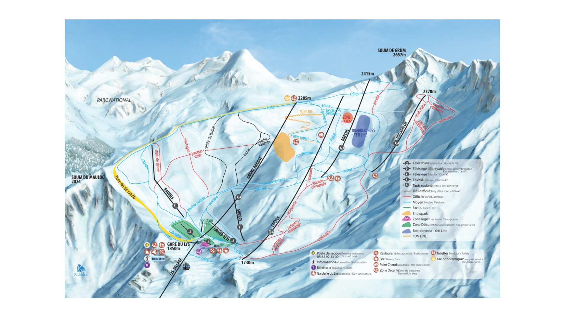
Located in the scenic Cauterets valley, Le Lys is a charming destination for skiers and snowboarders looking for a relaxed yet varied experience. The resort sits in a sun-filled alpine bowl surrounded by rugged peaks, offering wide, groomed pistes and breathtaking views. Its combination of high-altitude runs and tree-lined slopes makes it enjoyable for both beginners seeking confidence and more experienced riders looking for scenic cruising.
Le Lys is particularly appealing for its accessibility and variety. Beginners have gentle slopes and dedicated learning zones, while intermediates can explore long red runs that traverse the resort. Advanced skiers and snowboarders can enjoy selective black runs and off-piste terrain for a more challenging experience. Compact lift networks and convenient village facilities ensure easy navigation, making it an ideal choice for families, small groups, or anyone looking for a peaceful Pyrenean skiing adventure.
Total ski area: 36 km / 22 miles
Base elevation: 900 m / 2,953 ft
Peak elevation: 2,400 m / 7,874 ft
Difficulty:
🟦 59% Easy
🟥 33% Intermediate
⬛ 8% Advanced
Ski Season Length and Dates
Typically mid-December to late March, depending on snow conditions.
Is it good for beginners?
Le Lys is very beginner-friendly. Almost half the slopes are easy, with gentle nursery areas and slow-paced runs that help novices progress comfortably.
What’s Included in the Ski Pass?
- Access to all lifts at Le Lys
- Beginner slopes and practice areas
- Blue, red, and black runs
- Snowparks (when open)
- Shuttle connections within Cauterets
Pass options
- The pass covers the full Le Lys resort.
- Since it’s a single compact area, cheaper sector-only passes aren’t typically available; the full pass gives access to all slopes and lifts.