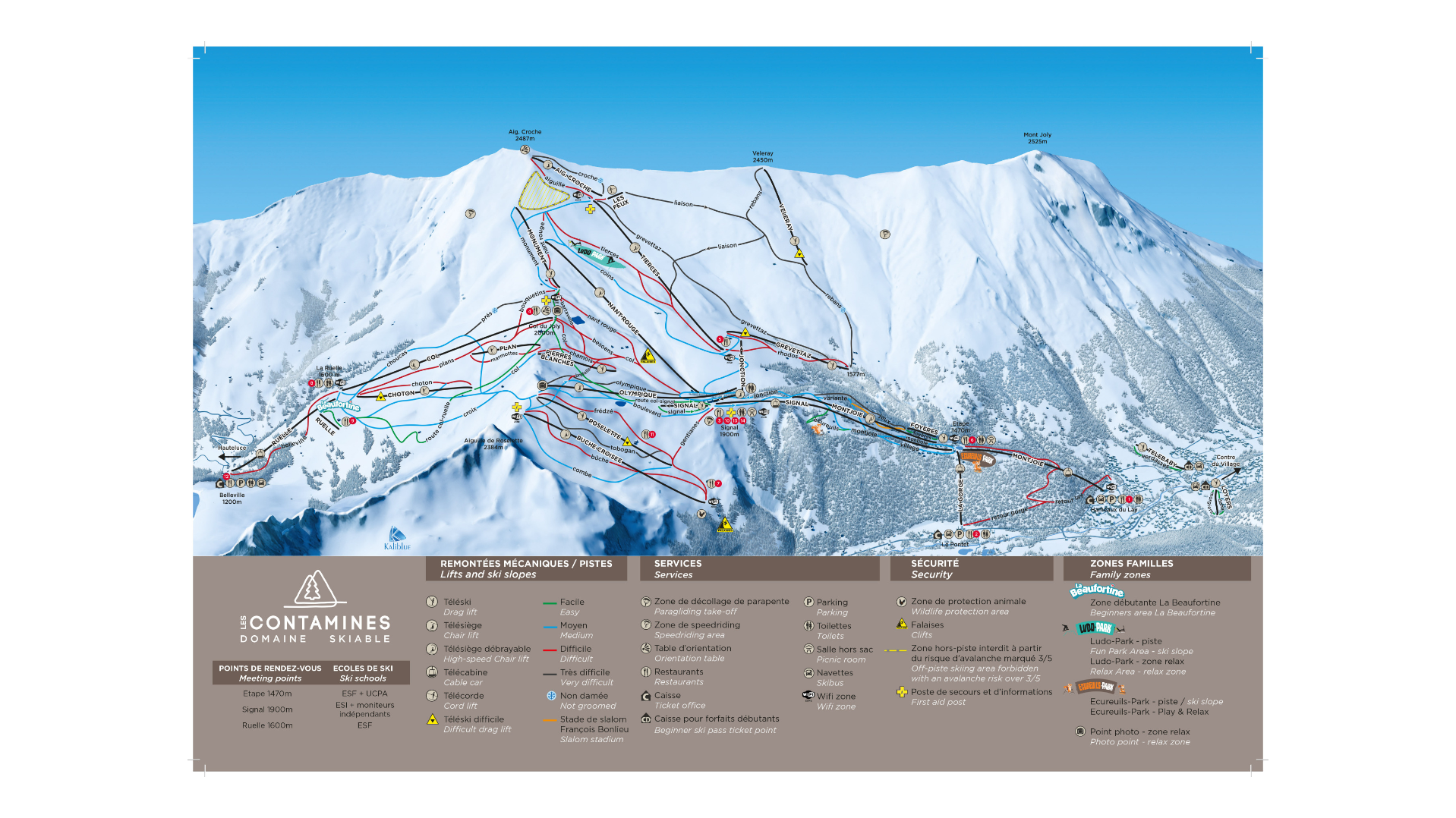
Les Contamines Ski Map Download 👇
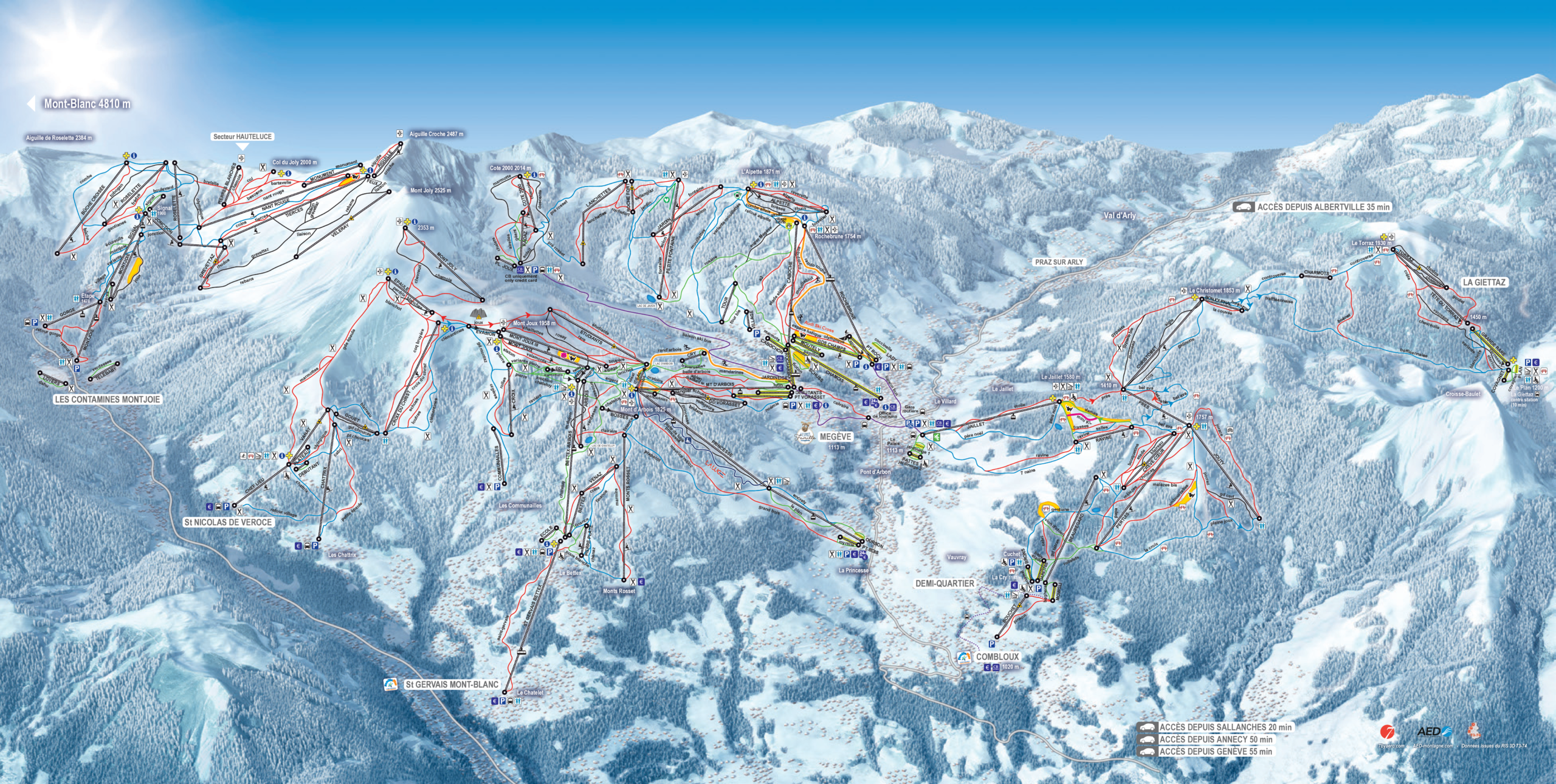
Les Contamines Piste Map and Overview
Les Contamines‑Montjoie is a real Alpine treasure: its ski area feels wonderfully traditional, with pistes winding through forested valleys and high alpine terrain framed by the Mont Blanc massif. The resort offers a mix of runs suited to all levels – from peaceful green and blue slopes for beginners to exhilarating red and black pistes high above in the Tierces and Roselette sectors. What makes it special is this variety, combined with a warm, friendly mountain village atmosphere: cozy chalets, a family feel, and plenty of scenic spots to soak in the views of Mont Blanc.
On top of that, Les Contamines is very appealing for freeriders and ski tourers. The ski lift company highlights that from the highest lifts (up to ~2,485 m) you can access long off‑piste descents, and there are marked touring routes for skinning uphill. Whether you’re carving groomers or exploring untouched snow, there’s a lot of freedom and adventure to be had.
Total ski area: 120 km / 75 miles
Base elevation: 1,200 m / 3,937 ft
Peak elevation: 2,500 m / 8.202 ft
Difficulty:
🟦 33% Easy
🟥 50% Intermediate
⬛ 17% Advanced
What’s included in the Les Contamines Ski Pass?
- The Évasion Mont‑Blanc ski pass covers six resorts: Les Contamines / Hauteluce, Saint‑Gervais, Megève, Combloux, Saint‑Nicolas-de-Véroce, and La Giettaz.
- That pass gives you access to around 445 km of slopes across the combined domain.
- There is an option to buy a more limited, local pass: the Contamines / Hauteluce 6-day pass gives you full access to that area only, without the rest of the Évasion domain.