Val d’Isère Ski Map Download 👇
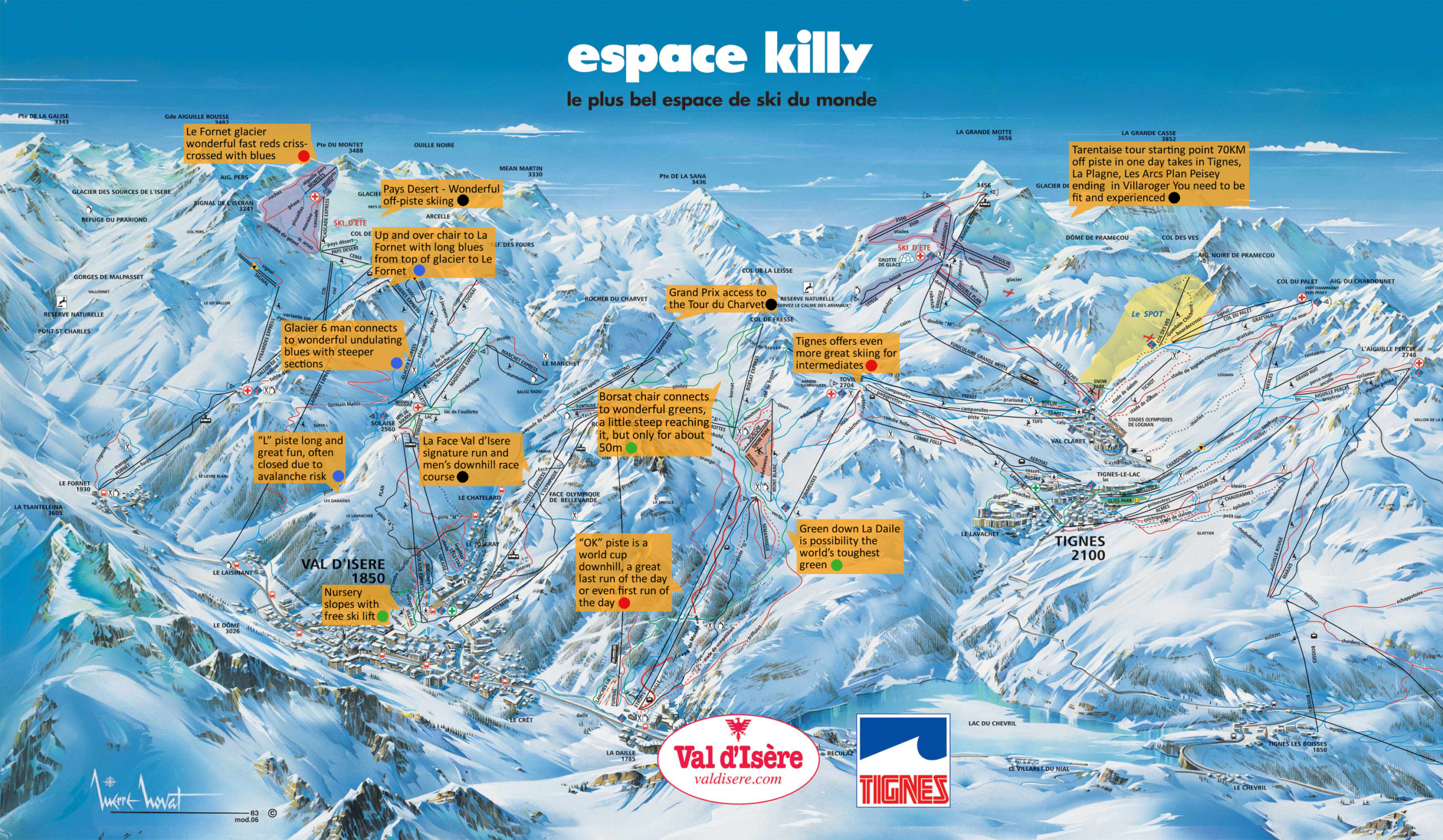
Val d’Isère Piste Map and Overview
Perched high in France’s Tarentaise Valley, Val d’Isère combines serious alpine terrain and snow‑guarantee with a lively resort atmosphere. At its base it sits around 1,850 m and lifts climb to 3,456 m, meaning the skiing stretches across high‑altitude glaciers, steep descent zones and long, sweeping pistes. Because the terrain covers such a vertical and elevation span, the snow cover tends to be reliable even in marginal conditions, making Val d’Isère a strong choice from early season through spring.
Beyond the skiing, the resort village offers a blend of traditional Alpine charm and first‑class infrastructure: modern lifts, well‑groomed runs, wide variety of terrain levels (from beginners up to expert off‑piste), plus the vibrant après‑ski scene. With the neighbouring Tignes connection (forming the combined domain often referred to as the Espace Killy), you’ll find flexibility – ski when you want to push your limits, or relax on gentler slopes when you feel like it.
Total ski area: 300 km / 186 miles
Base elevation: 1,850 m / 6,069 ft
Peak elevation: 3,456 m / 11,339 ft
Difficulty:
🟦 55% Easy
🟥 25% Intermediate
⬛ 20% Advanced
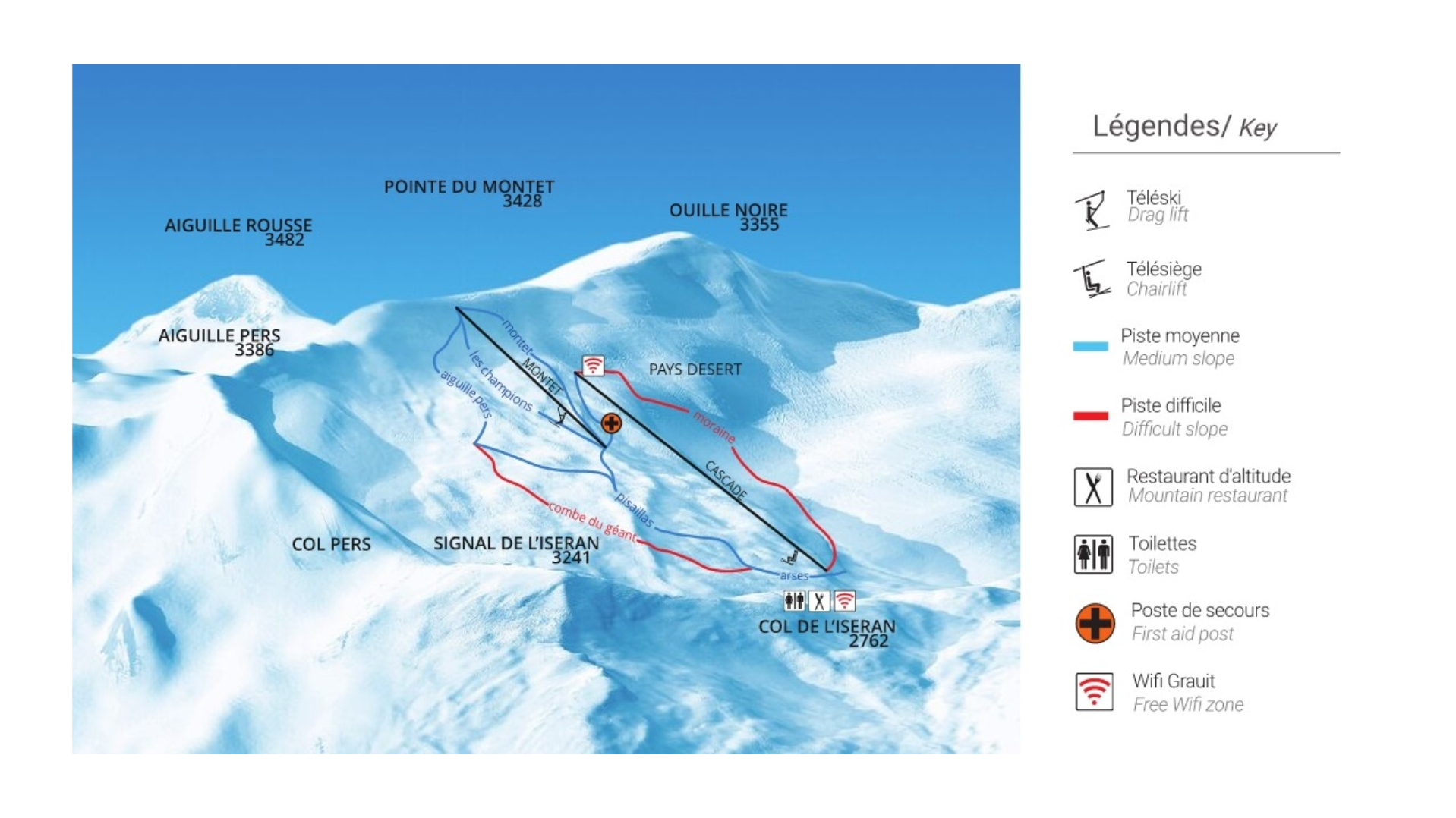
Glacier du Pisaillas – Summer Skiing Val d’Isère
Tucked high above Val d’Isère, the Pisaillas Glacier offers a truly alpine summer skiing experience, with pistes running between roughly 3,300 m and 2,725 m. You’ll find a handful of runs open in summer: three that are accessible to everyone (Moraine, Montet, Combe du Géant), plus several more reserved for serious ski teams and athletes in training. The lifts running in this period are the Cascade chairlift and the Montets drag lift, which give access to the glacier’s high points and its sweeping, sun-drenched slopes.
Summertime skiing here has a strong training and performance vibe, but it’s also surprisingly accessible – a one-day pass is around €36, and if you’re around for a few days or want to make the most of the short season, there are multi-day or season passes too. The sessions run each morning, from around 07:00 until noon, when the glacier’s snow softens. Plus, the setting is spectacular: you’re gliding above the tree line, with panoramic views that stretch across the Vanoise peaks – a special treat for both freeriders and summer ski fans.