Saalbach Ski Map Download 👇
Saalbach Piste Map and Overview
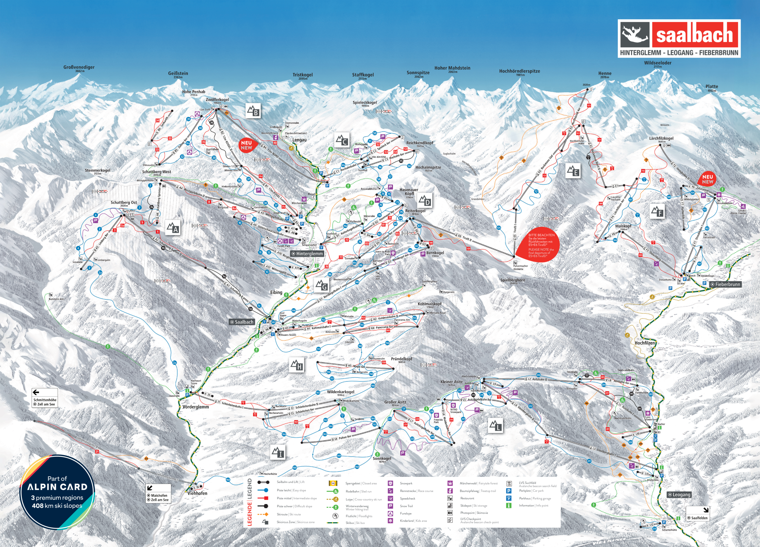
Saalbach is part of a much larger ski area known as the “SkiCircus”. This connects Saalbach to Hinterglemm, Leogang and Fieberbrunn – with a somewhat new connection to Zell Am See (Via a quick 5 minute bus ride at the bottom of a gondola). It is almost impossible to provide a map of just Saalbach, as the whole area is so intertwined. You can easily ski from one ski area to the next – prooviding endless slopes for your next Winter trip. We spent a whole season here, an will be back for another soon. Saalbach is truly a special place.
Nestled in the Austrian Alps, the town itself is a picturesque haven with traditional Tyrolean architecture, lively après-ski venues, and a welcoming ambiance. Its central location within the vast Skicircus Saalbach-Hinterglemm-Leogang-Fieberbrunn makes it a hub for skiers of all levels. The town is well-equipped with modern amenities, including ski schools, rental shops, and a variety of accommodation options, ranging from cozy guesthouses to luxurious hotels, ensuring a comfortable stay for all visitors.
The slopes of Saalbach are what truly set it apart as a top-tier ski resort. The Skicircus area offers over 270 kilometers of interconnected slopes, catering to everyone from beginners to seasoned experts. The terrain is diverse, with wide, groomed pistes for leisurely skiing and more challenging off-piste areas for those seeking adventure. The region is also known for its state-of-the-art lift system, which reduces wait times and maximizes time on the snow. Additionally, Saalbach enjoys reliable snowfall and extensive snowmaking capabilities, ensuring excellent skiing conditions throughout the season. With its combination of scenic beauty, extensive ski area, and vibrant town life, Saalbach is an ideal choice for an unforgettable ski holiday.
Ski area size = 270 km / 168 miles
Base elevation = 830 m / 2,731 ft
Peak elevation = 2,096 m / 6877 ft
Difficulty:
🟦 52% Easy
🟥 41% Intermediate
⬛ 7% Advanced