Innerkrems Ski Map Download 👇
Innerkrems Piste Map and Overview
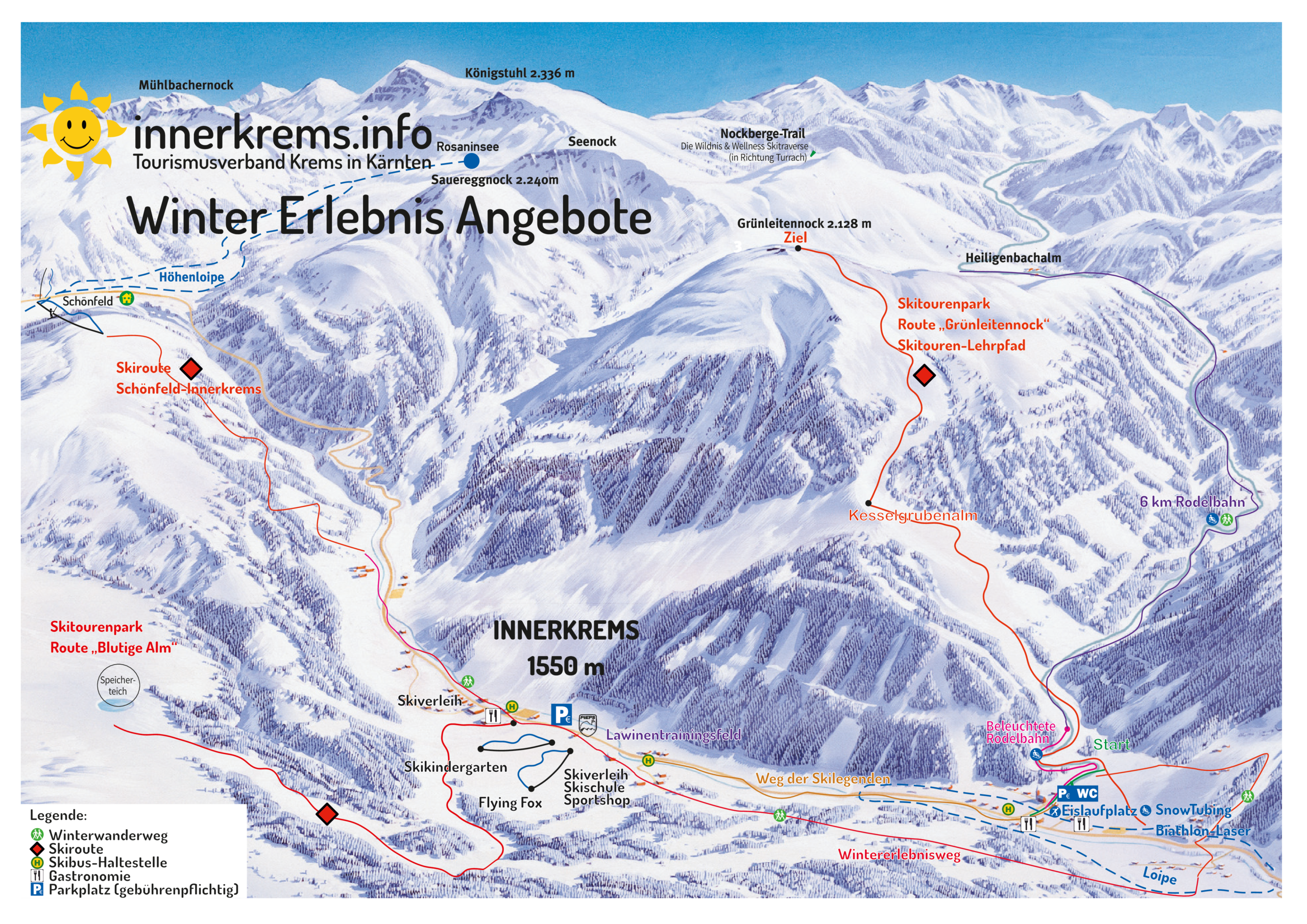
Innerkrems is a charming ski resort located in the Nockberge region of Carinthia, Austria, offering a tranquil and family-friendly alpine experience. With a base elevation of 1,550 meters (5,085 feet) and a peak at 2,200 meters (7,218 feet), the resort boasts reliable snow conditions from early December through April. The ski area features 45 kilometers (28 miles) of well-maintained pistes, including a mix of blue, red, and black runs suitable for all skill levels. The resort is equipped with 9 lifts, ensuring minimal wait times and easy access to the slopes. For those seeking off-piste adventures, Innerkrems offers 25 kilometers (16 miles) of ski routes and a dedicated freeride area known as the “Blutige Alm.”
Beyond skiing, Innerkrems is renowned for its peaceful atmosphere, making it an ideal destination for families and those looking to escape the crowds. The resort’s commitment to snow reliability is evident, with 80% of the terrain covered by snowmaking systems. Additionally, Innerkrems is part of the TopSkiPass Kärnten & Osttirol network, granting access to a broader range of ski areas in the region.
Total ski area size: 45 km / 28 miles
Base elevation: 1,550 m / 5,085 ft
Peak elevation: 2,200 m / 7,218 ft
Difficulty:
🟦 19% Easy
🟥 75% Intermediate
⬛ 6% Advanced