Heiligenblut Ski Map Download 👇
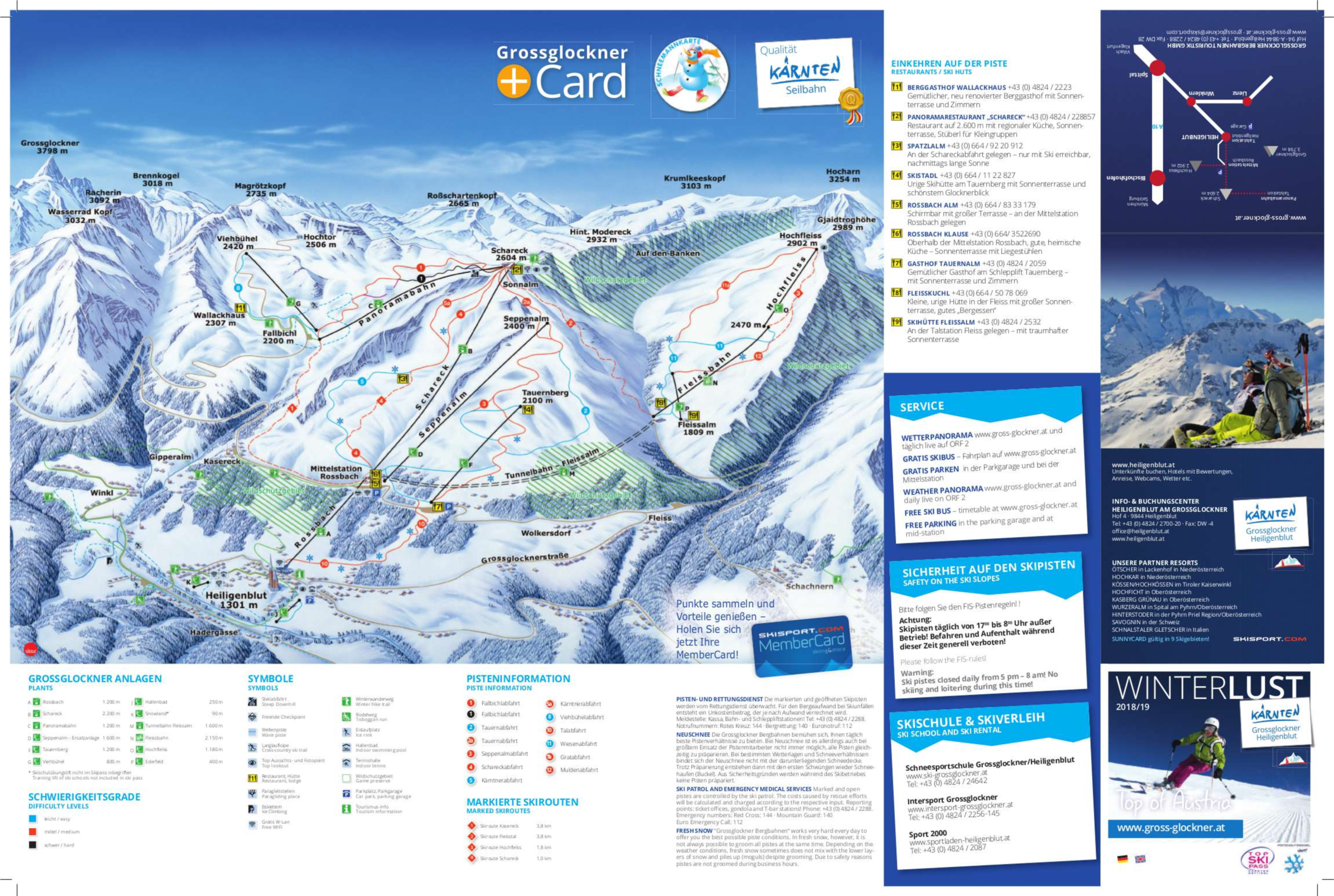
Heiligenblut Piste Map and Overview
Heiligenblut, located in Austria’s Carinthia region, is a picturesque alpine village nestled at the foot of the Grossglockner, the highest mountain in Austria. It’s a top destination for skiing enthusiasts who want to enjoy both thrilling descents and scenic beauty. The ski area, part of the Hohe Tauern National Park, offers an uncrowded, family-friendly atmosphere with well-maintained slopes, a variety of terrain for all skill levels, and reliable snow conditions throughout the winter season.
What sets Heiligenblut apart is its combination of natural beauty and accessible adventure. From long, carving runs to freeride zones and panoramic views, skiers are treated to an immersive mountain experience. The resort’s relatively high elevation ensures good snow reliability, and its modern lift infrastructure minimizes wait times. Beyond skiing, the charming village atmosphere and traditional Austrian hospitality make it a well-rounded winter getaway.
Total ski area size: 55 km / 34 miles
Base elevation: 1,301 m / 4,268 ft
Peak elevation: 2,989 m / 9,806 ft
Difficulty:
🟦 36% Easy
🟥 62% Intermediate
⬛ 2% Advanced