Annaberg Ski Map Download 👇
Annaberg Piste Map and Overview
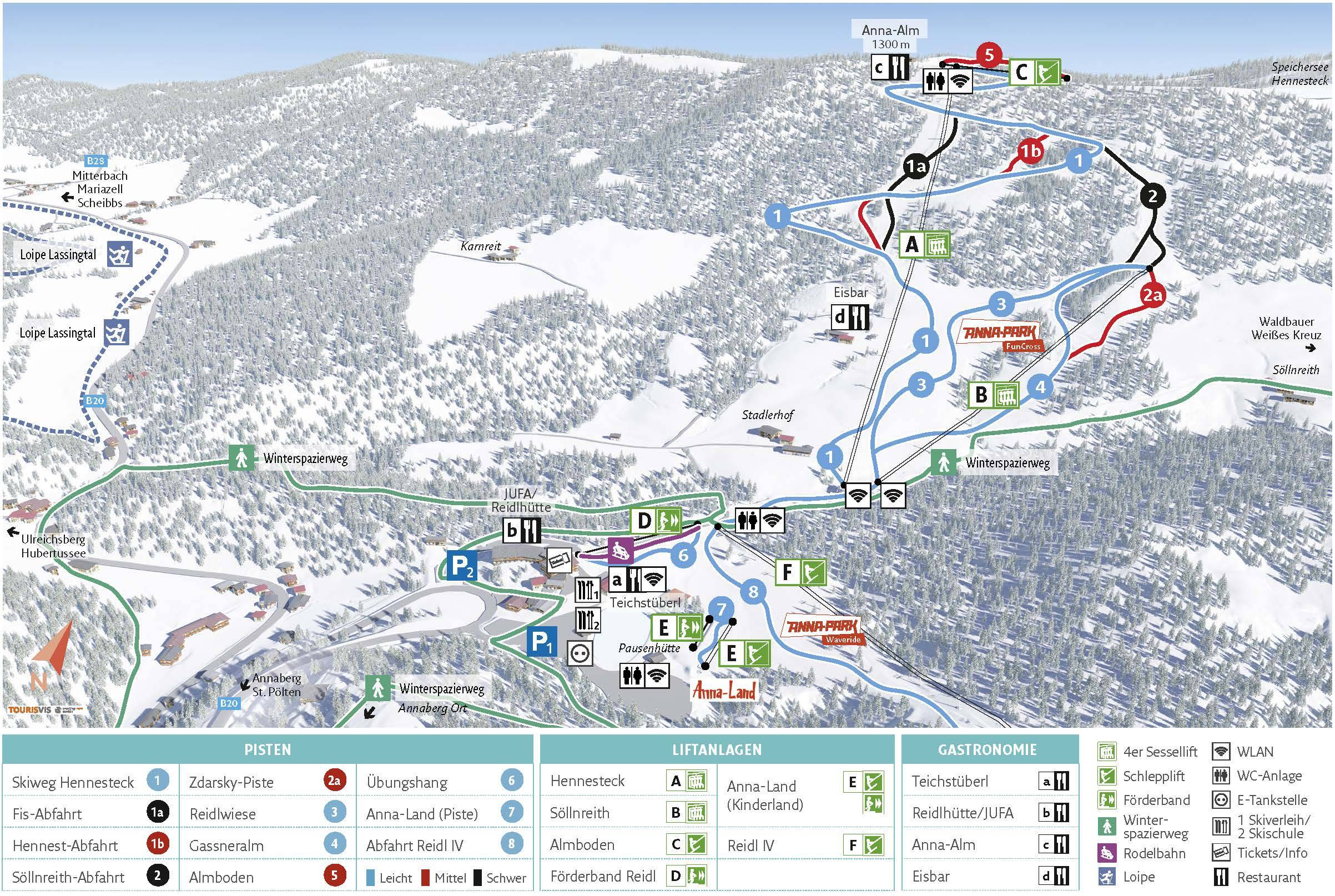
Annaberg, located in Lower Austria, is a charming ski resort ideal for families and beginners seeking a relaxed alpine experience. The resort offers approximately 12.5 km (7.8 miles) of groomed slopes, with elevations ranging from 896 m (2,940 ft) at the base to 1,300 m (4,265 ft) at the summit, providing a vertical drop of 404 m (1,325 ft). The resort features a variety of runs suitable for different skill levels, including a fun park for snowboarders and freestylers, as well as a children’s ski land and a toboggan run, ensuring entertainment for all ages.
Beyond its well-maintained pistes, Annaberg is renowned for its family-friendly atmosphere and panoramic views of the surrounding alpine landscape. The resort features a modern lift system, including a gondola and several tow lifts, ensuring efficient access to various parts of the mountain. Additionally, Annaberg’s location offers a unique cross-border experience, as the mountain straddles Austria and Slovenia, providing cultural diversity and a rich history to explore. Whether you’re a beginner seeking gentle slopes or an experienced skier looking for longer runs, Annaberg offers a well-rounded alpine experience.
Total ski area size: 12.5 km / 7.8 miles
Base elevation: 896 m / 2,940 ft
Peak elevation: 1,300 m / 4,265 ft
Difficulty:
🟦 64% Easy
🟥 20% Intermediate
⬛ 16% Advanced