Les Arcs Ski Map Download 👇
Les Arcs Piste Map and Overview
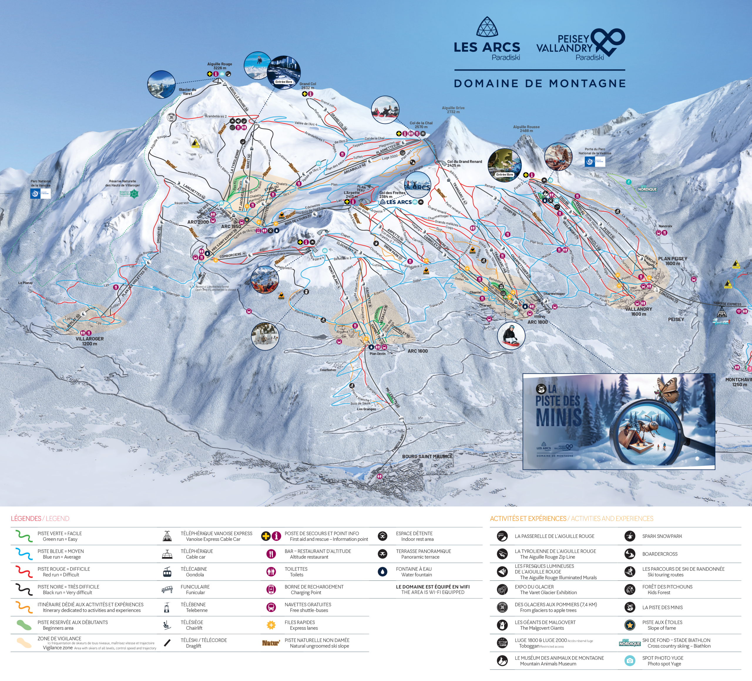
Les Arcs, part of the vast Paradiski area in the French Alps, is a popular ski resort known for its modern infrastructure, extensive terrain, and incredible views of Mont Blanc. Spread across four main villages—Arc 1600, Arc 1800, Arc 1950, and Arc 2000—Les Arcs offers a mix of traditional Alpine charm and modern conveniences, making it a great destination for all types of visitors. The villages provide a range of accommodations, from cozy chalets to high-end apartments, and have vibrant après-ski options with bars, restaurants, and shops. Les Arcs is also a great choice for families, with excellent ski schools and beginner-friendly areas.
The skiing at Les Arcs is varied and exciting, with over 200 kilometers (124 miles) of pistes that cater to all levels of skiers. Beginners and intermediates will enjoy the wide, gentle slopes and scenic blue and red runs, while advanced skiers can tackle the challenging black runs and off-piste terrain. Les Arcs is also home to the famous “Aiguille Rouge” run, one of the longest and most thrilling descents in the Alps, stretching 7 kilometers with a vertical drop of over 2,000 meters. The resort is well-known for its freestyle scene, boasting multiple snow parks and a half-pipe, making it popular with snowboarders and freestyle skiers. With its reliable snow conditions, high altitude, and modern lift system, Les Arcs is an excellent destination for skiers of all abilities.
Les Arcs is connected to La Plagne, making this one of the largest skiing areas in the world!
Total ski area: 200 km / 124 miles
Base elevation: 1,200 m / 3,937 ft
Peak elevation: 3,226 m / 10,584 ft
Difficulty:
🟦 52% Easy
🟥 35% Intermediate
⬛ 13% Advanced