
Åre Ski Map Download 👇
Åre Piste Map and Overview
Åre, Sweden, is one of Scandinavia’s largest and most popular ski resorts, known for its diverse terrain, vibrant village atmosphere, and long ski season. Are, Sweden has three ski maps. Above you can see the Village (Or Åre By) ski map, and below we will show the other two – Åre Duved/Tegefjäll ski map and Åre Björnen ski map.
Located in the Jämtland region, Åre offers a perfect mix of modern amenities and traditional Scandinavian charm. The resort has a lively village with plenty of restaurants, bars, and shops, providing an energetic après-ski scene alongside more relaxed options like saunas and cozy cafes. In addition to skiing, Åre is famous for its winter activities, including dog sledding, snowmobiling, and ice climbing, making it a true winter adventure destination.
The skiing in Åre is exceptional, with 91 kilometers (57 miles) of varied terrain spread across three main ski areas: Åre By, Åre Björnen, and Duved/Tegefjäll. Åre By, the main area, offers challenging slopes, including some steep black runs and fantastic off-piste opportunities for advanced skiers. Åre Björnen is more family-friendly, with gentle slopes perfect for beginners and children. Duved/Tegefjäll, located a bit farther out, provides quiet runs and excellent tree skiing. The resort’s highest point reaches 1,274 meters, providing spectacular views of the surrounding mountains and lake. Åre is known for its reliable snow conditions and modern lift system, which ensures easy access to the entire ski area. With its combination of excellent skiing, vibrant village life, and a wide range of activities, Åre is a top ski destination in Northern Europe.
Åre Duved/Tegefjäll Piste Map and Overview

Åre Duved/Tegefjäll Ski Map Download 👇
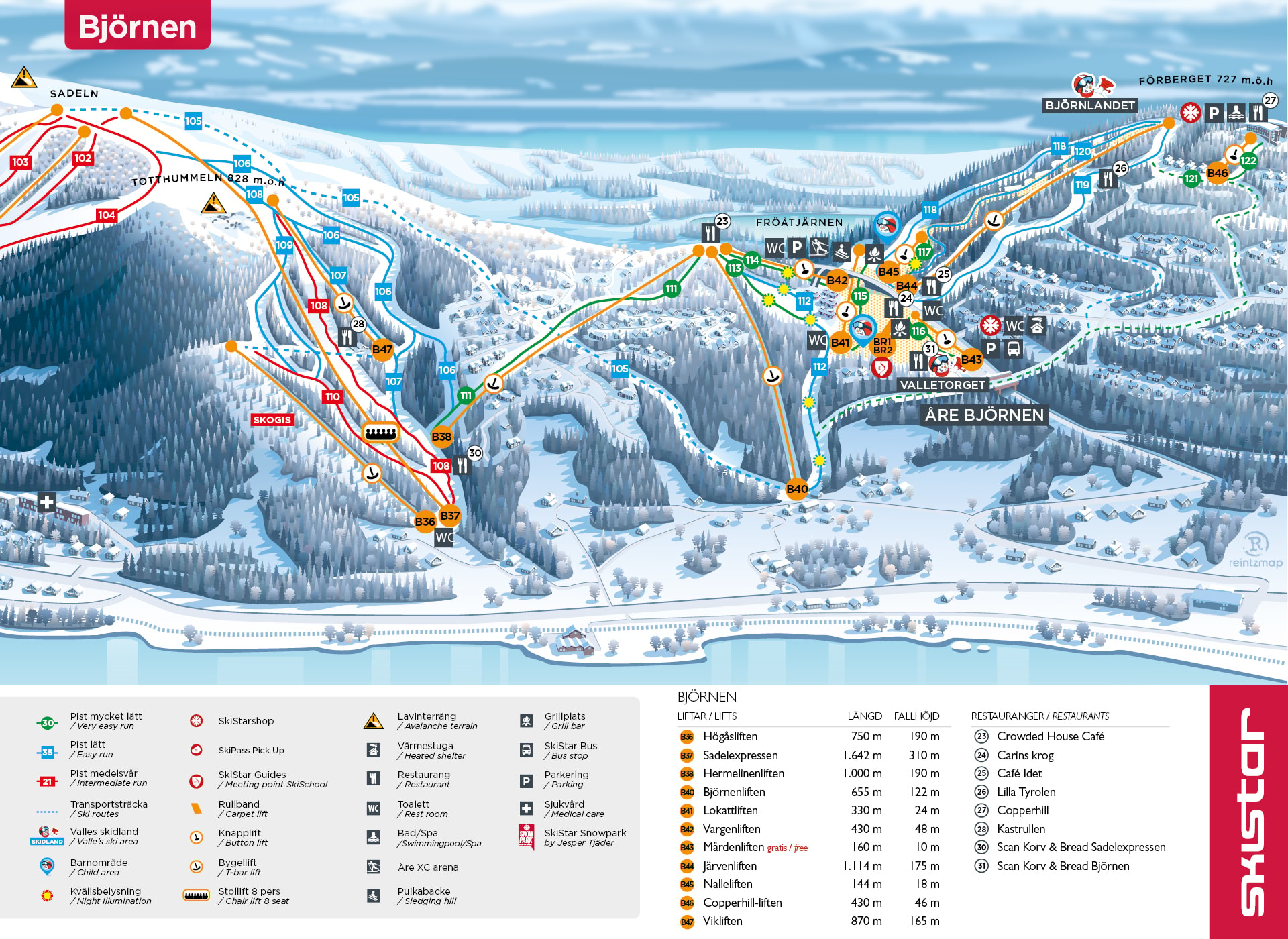
Åre Björnen Piste Map and Overview
Åre Björnen Ski Map Download 👇
Total ski area: 91 km / 57 miles
Base elevation: 380 m / 1,247 ft
Peak elevation: 1,274 m / 4,180 ft
Difficulty:
🟦 49% Easy
🟥 42% Intermediate
⬛ 9% Advanced