Tignes Ski Map Download 👇
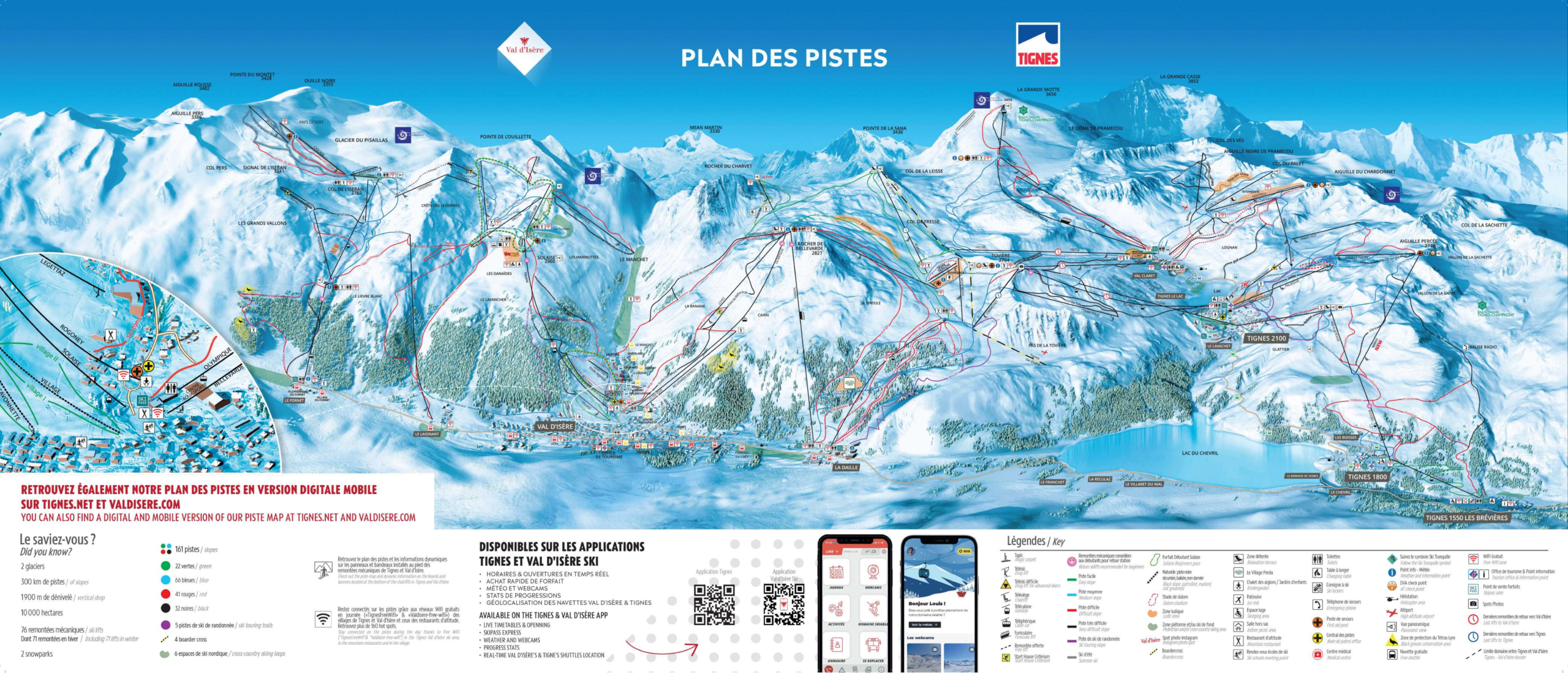
Tignes Piste Map and Overview
Nestled high in the French Alps, Tignes (linked with Val d’Isère to form a massive ski domain) offers one of the most snow-reliable and expansive ski areas in Europe. With slopes rising up to approximately 3,456 m, you enjoy high-altitude terrain where the snow tends to stay firm and good for longer seasons. The connectivity between the different villages and lifts means you can explore a vast variety of terrain in a single day – from wide groomed cruisers to steeper challenges and glacier skiing.
In addition, the landscape is dramatic: broad Alpine bowls, high-altitude plateaus, and glacier access provide both beginner/intermediate friendly runs and expert terrain off the beaten track. The resort is also well geared for all-round skiing enjoyment – whether you want long scenic descents, freeride zones, or terrain for gradual progression. As one guide puts it, the “motorway-wide intermediate pistes” at high altitude are a real plus.
Total ski area: 300 km / 187 miles
Base elevation: 1,550 m / 5,085 ft
Peak elevation: 3,456 m / 11,339 ft
Difficulty:
🟦 55% Easy
🟥 25% Intermediate
⬛ 20% Advanced