Whitetail Resort Ski Map Download 👇
Whitetail Resort Piste Map and Overview
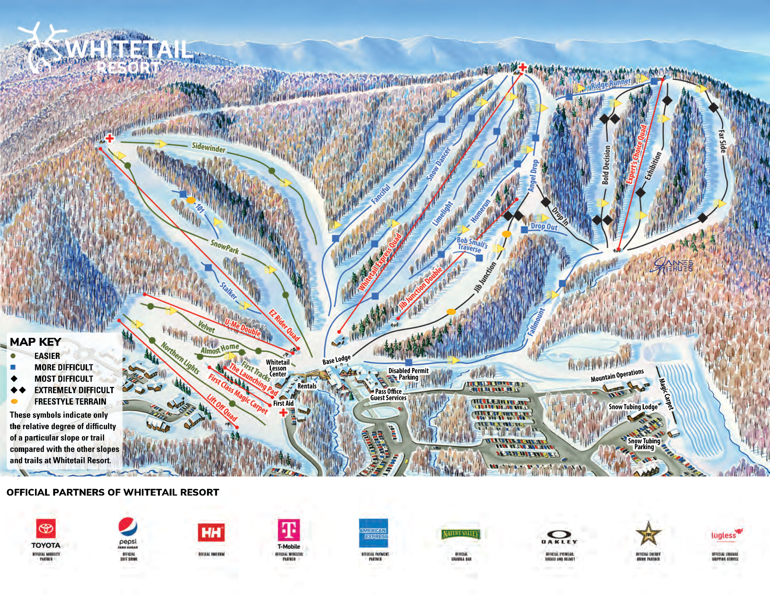
Located in Montgomery Township, Franklin County, Pennsylvania, Whitetail Resort offers a convenient and family-friendly skiing experience, serving the Baltimore-Washington Metropolitan Area. The resort features 25 trails, including 7 beginner, 11 intermediate, and 4 advanced runs, catering to a wide range of skill levels. With a vertical drop of 935 feet (285 meters), it provides ample terrain for downhill skiing and snowboarding. The longest run, “Limelight,” stretches approximately 4,900 feet (1,494 meters), offering skiers a sustained descent. The resort also boasts a terrain park, ensuring diverse options for freestyle enthusiasts.
Whitetail Resort is equipped with a comprehensive lift system, including 1 high-speed quad chairlift, 3 quad chairlifts, 2 double chairlifts, and 2 surface lifts, ensuring efficient access to the slopes. Additionally, the resort offers night skiing on 100% of its terrain, allowing for extended skiing hours. With 100% snowmaking coverage, Whitetail ensures consistent and quality snow conditions throughout the season. The resort operates a snow tubing park alongside the ski hill, providing additional recreational options.
Total ski area: 10.2 km / 6.3 mi
Base elevation: 264 m / 865 ft
Peak elevation: 549 m / 1,800 ft
Difficulty:
🟦 15% Easy
🟥 55% Intermediate
⬛ 30% Advanced