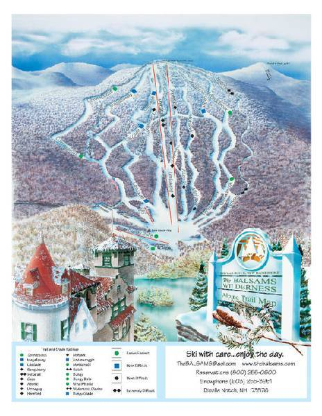
The Balsams Ski Map Download 👇
The Balsams Piste Map and Overview
The Balsams (formerly Balsams Wilderness Ski Area) is a historic and potentially massive ski destination located in Dixville Notch, New Hampshire. Although it’s currently closed – having shuttered in 2011 – it boasts impressive natural terrain and ambitious expansion plans. The existing slope infrastructure provides about 12.6 km (≈ 7.8 miles) of alpine trails served by a single lift, with a vertical drop from approximately 541 m to 838 m (297 m / 974 ft). What makes The Balsams noteworthy, however, is the nearly decade‑long redevelopment effort aiming to scale it up dramatically.
Under a revamped master plan led by Les Otten and partners, the resort aims to grow to roughly 2,200 acres of skiable terrain and install 22 lifts, including a gondola reaching Dixville Peak – ushering in an expansive, varied mountain experience. When fully realized, the vertical drop will reach around 625 m (2,050 ft) from the new base and summit elevations at about 715 m (2,350 ft) and 1,335 m (4,385 ft) respectively. Whether you’re nostalgic for its mid-century charm or excited by the ambitious transformation, The Balsams represents both a ski area with deep roots and big East Coast potential.
Ski area size = 12.6 km / 7.8 miles
Base elevation = 541 m / 1,775 ft
Peak elevation = 838 m / 2,749 ft
Difficulty:
🟦 27% Easy
🟥 32% Intermediate
⬛ 41% Advanced
