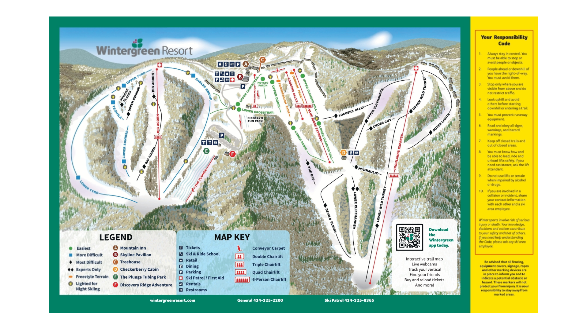
Wintergreen Resort Ski Map Download 👇
Wintergreen Resort Piste Map and Overview
Wintergreen Resort, located in the Blue Ridge Mountains of Virginia, offers a diverse skiing experience suitable for all skill levels. With 129 skiable acres and a vertical drop of 1,003 feet (306 meters), the resort provides a variety of terrain across its 26 trails. The trail difficulty is distributed as follows: 20% beginner, 40% intermediate, and 40% advanced. The resort’s longest run, Tyro, extends 1.4 miles (2.25 kilometers), offering a satisfying descent for visitors. Wintergreen is equipped with 100% snowmaking coverage and offers night skiing on 54% of its terrain, ensuring consistent conditions and extended hours for guests.
Wintergreen Resort also features a terrain park and offers a range of amenities, including dining options and lodging, making it a comprehensive destination for winter sports enthusiasts.
Ski area size = 129 acres / 0.52 km²
Base elevation = 2,512 ft / 766 m
Peak elevation = 3,515 ft / 1,071 m
Difficulty:
🟦 20% Easy
🟥 40% Intermediate
⬛ 40% Advanced
