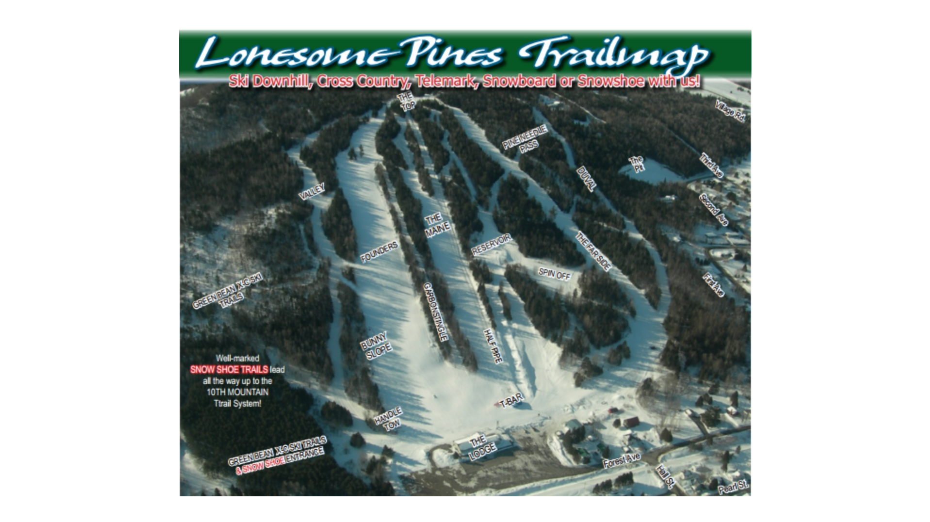
Lonesome Pine Trails Ski Map Download 👇
Lonesome Pine Trails Piste Map and Overview
Lonesome Pine Trails, situated in Fort Kent, Maine, is the northernmost ski area in New England. This community-run resort offers a welcoming atmosphere and a variety of terrain suitable for skiers and snowboarders of all levels. With 13 trails and glades, the mountain provides a balanced mix of runs, complemented by two surface lifts that efficiently transport guests up the slopes. The resort is equipped with snowmaking capabilities and offers night skiing, ensuring consistent conditions and extended hours for winter enthusiasts. Its proximity to downtown Fort Kent adds to its convenience, making it an accessible destination for both locals and visitors.
Established in the 1964–65 season, Lonesome Pine Trails has a rich history rooted in community involvement. The resort’s base elevation is approximately 173 meters (568 feet), with a summit elevation of 299 meters (981 feet), resulting in a vertical drop of 126 meters (413 feet). Covering a skiable area of 115 acres (0.47 km²), the resort offers a compact yet diverse skiing experience. Its non-profit status and reliance on volunteers highlight the community’s dedication to maintaining and enhancing this cherished local ski area.
Ski area size = 115 acres / 0.47 km²
Base elevation = 173 m / 568 ft
Peak elevation = 299 m / 981 ft
Difficulty:
🟦 22% Easy
🟥 35% Intermediate
⬛ 43% Advanced
