Katschberg Ski Map Download 👇
Katschberg Piste Map and Overview
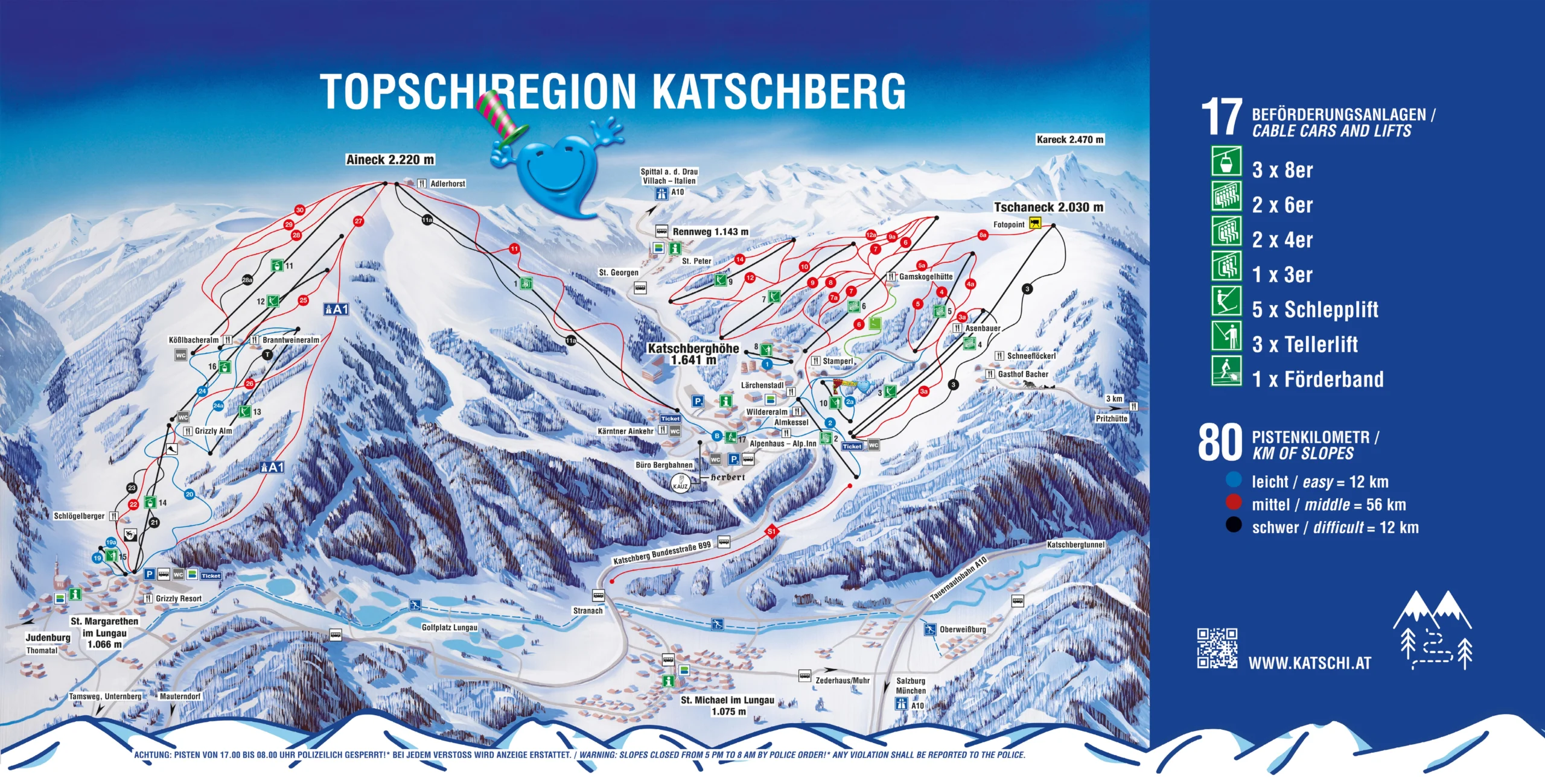
Katschberg is a high-altitude ski resort situated on the border between Carinthia and Salzburg in Austria, offering a diverse range of slopes suitable for all skill levels. The resort spans elevations from 1,066 meters (3,497 feet) at the base to 2,220 meters (7,280 feet) at the peak, ensuring excellent snow conditions throughout the ski season. With 80 kilometers (50 miles) of well-maintained pistes and 17 modern lifts, including gondolas and chairlifts, Katschberg provides efficient access to its varied terrain. The resort is renowned for its family-friendly atmosphere, featuring dedicated children’s areas and ski schools, making it an ideal destination for both beginners and experienced skiers.
Beyond skiing, Katschberg offers a range of amenities, including cozy alpine huts serving regional cuisine, ensuring a comfortable and enjoyable après-ski experience. The resort’s commitment to snow reliability is evident, with 100% of the slopes equipped with modern snow-making systems, allowing for consistent skiing conditions even during warmer periods. Its strategic location, easily accessible via the Tauern Autobahn (A10), makes Katschberg a convenient choice for skiers seeking a comprehensive alpine experience in Austria.
Total ski area size: 80 km / 50 miles
Base elevation: 1,066 m / 3,497 ft
Peak elevation: 2,220 m / 7,280 ft
Difficulty:
🟦 15% Easy
🟥 70% Intermediate
⬛ 15% Advanced