La Thuile Ski Map Download 👇
La Thuile Piste Map and Overview
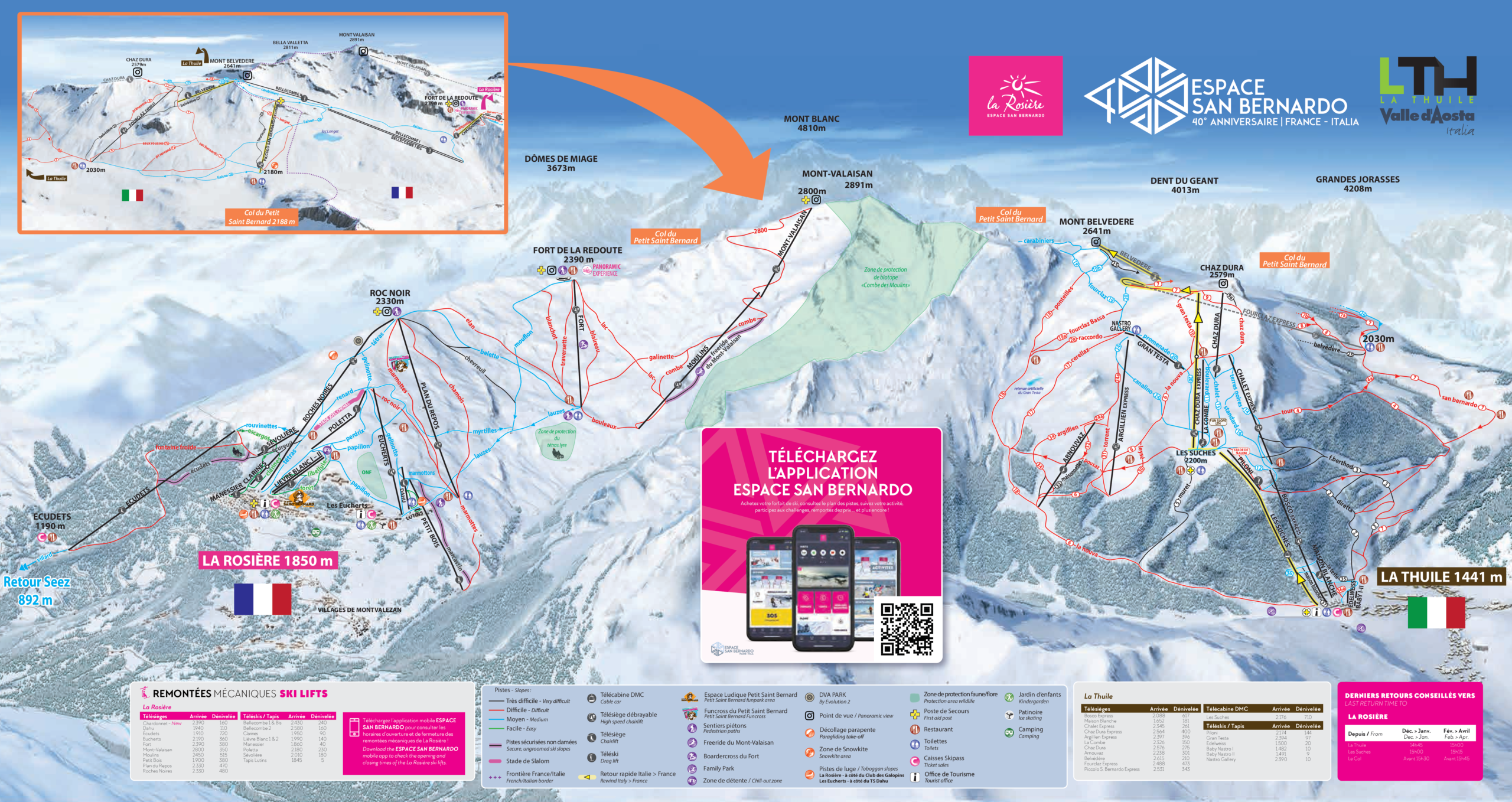
La Thuile, situated in Italy’s Aosta Valley, offers a unique cross-border skiing experience as part of the Espace San Bernardo ski area, which connects with La Rosière in France. The resort boasts 152 km (94 miles) of pistes, catering to all skill levels, from gentle beginner slopes to challenging runs like the Franco Berthod World Cup course, known for its steep gradients. With 38 lifts and elevations ranging from 1,441 m (4,728 ft) to 2,800 m (9,186 ft), skiers can enjoy a variety of terrains and stunning alpine views. The high altitude ensures reliable snow conditions throughout the season.
Beyond the slopes, La Thuile offers a charming village atmosphere with a range of accommodations and dining options. The resort is known for its affordability, making it an attractive destination for families and budget-conscious travelers. The seamless ski connection to La Rosière allows for an international skiing adventure, where visitors can experience the cultural nuances of both Italy and France in a single trip. Whether you’re seeking challenging runs or leisurely descents, La Thuile provides a comprehensive and memorable alpine experience.
Total ski area: 152 km / 94 miles
Base elevation: 1,441 m / 4,728 ft
Peak elevation: 2,800 m / 9,186 ft
Difficulty:
🟦 39% Easy
🟥 49% Intermediate
⬛ 12% Advanced